The view from inside the ice cave. On the ceiling, the ice looks polished reflecting the low light. Ski tracks and abandoned skis are in the entrance.
Arctic Expedition, Journey to Svalbard

Crossing Svalbard

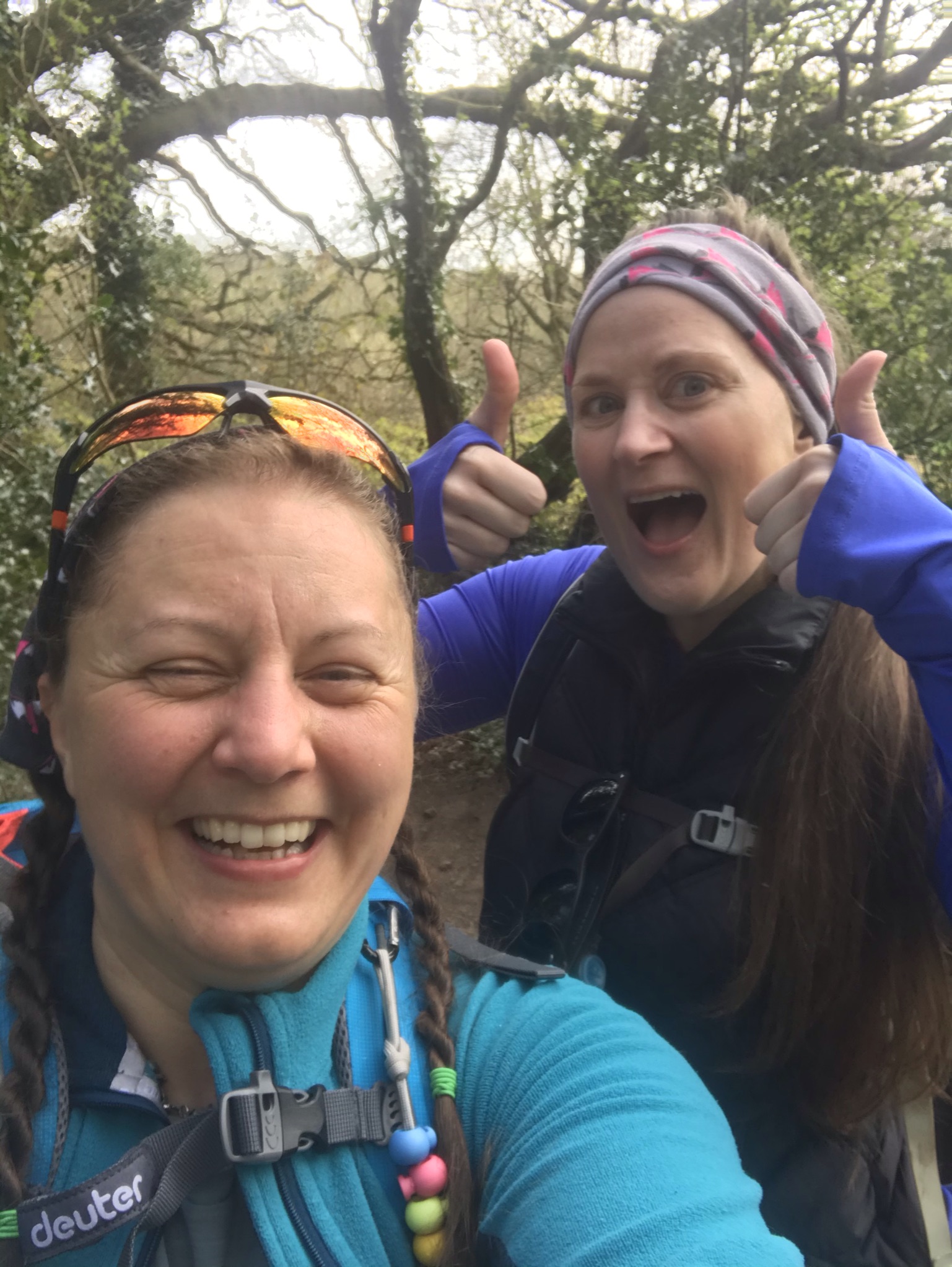
I’m a fan of keeping a journal, this blog is a more legible version of what I wrote while on Svalbard.

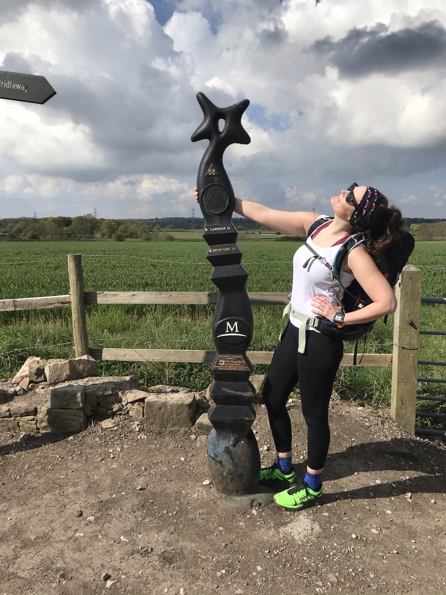
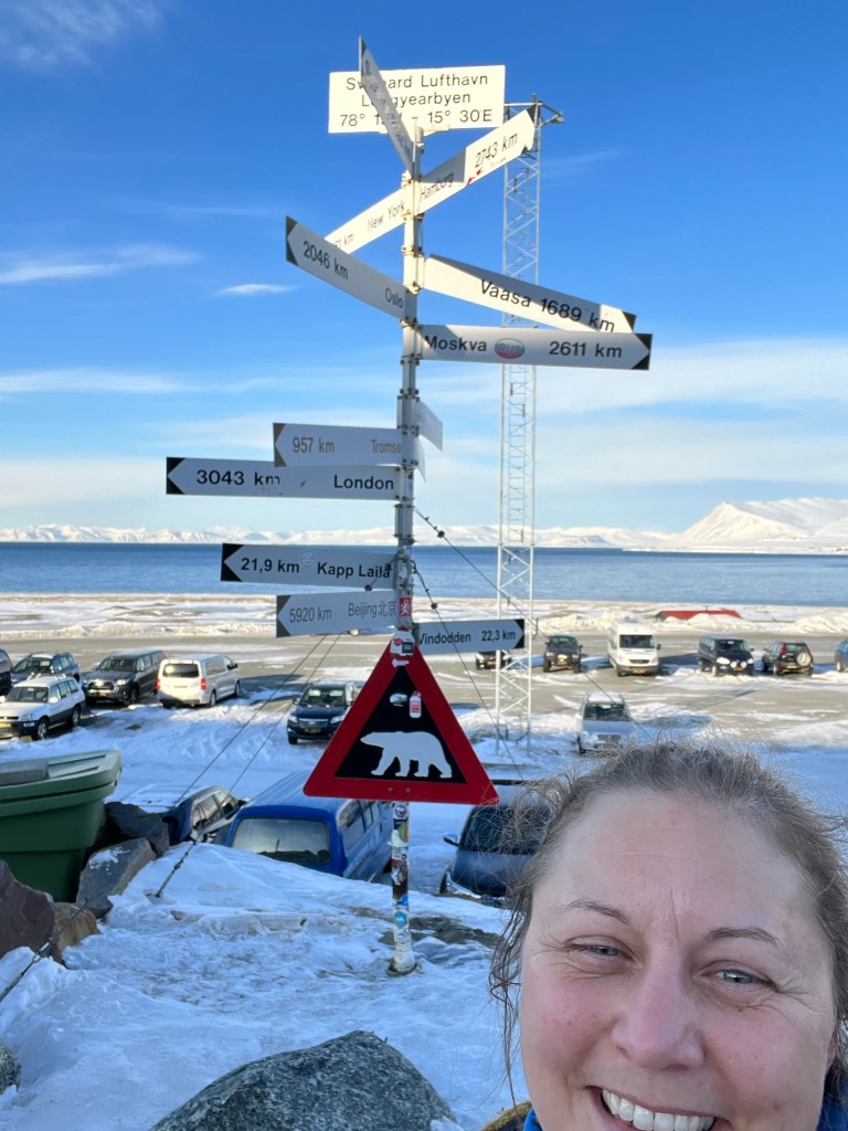
Pre-expedition Longyearbyen

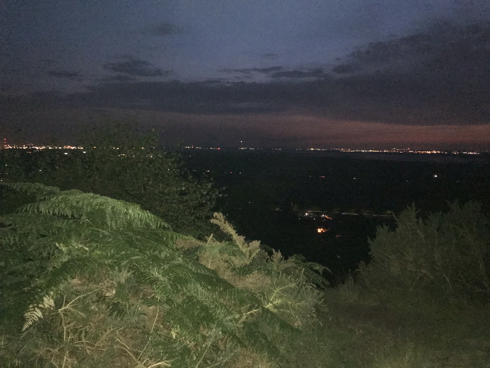
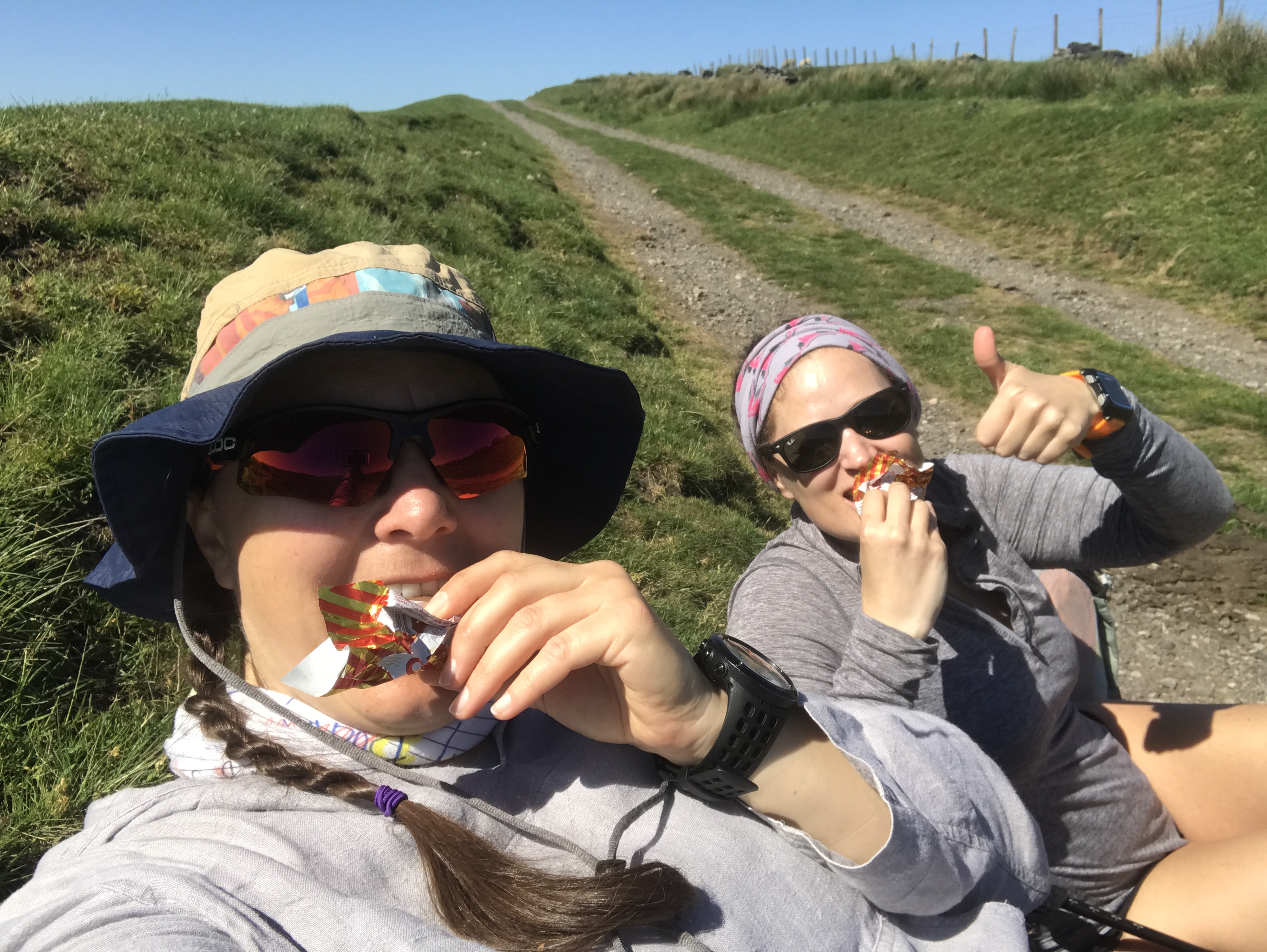
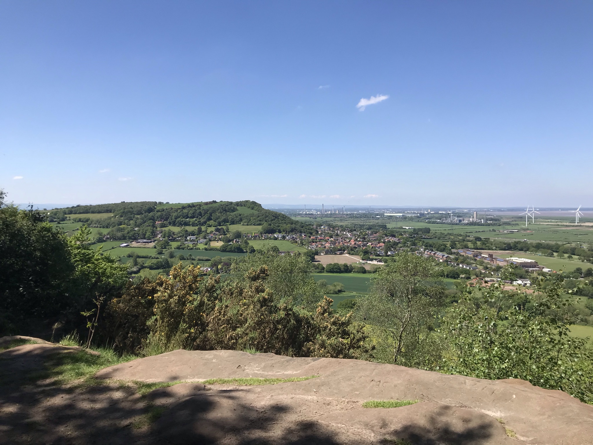
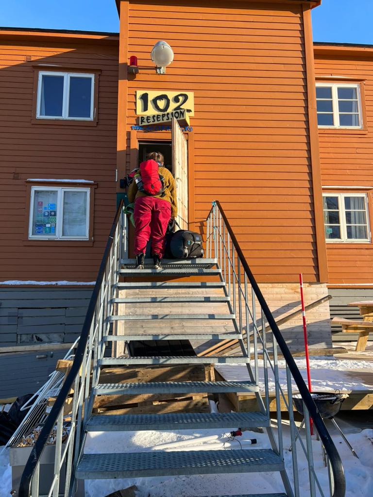
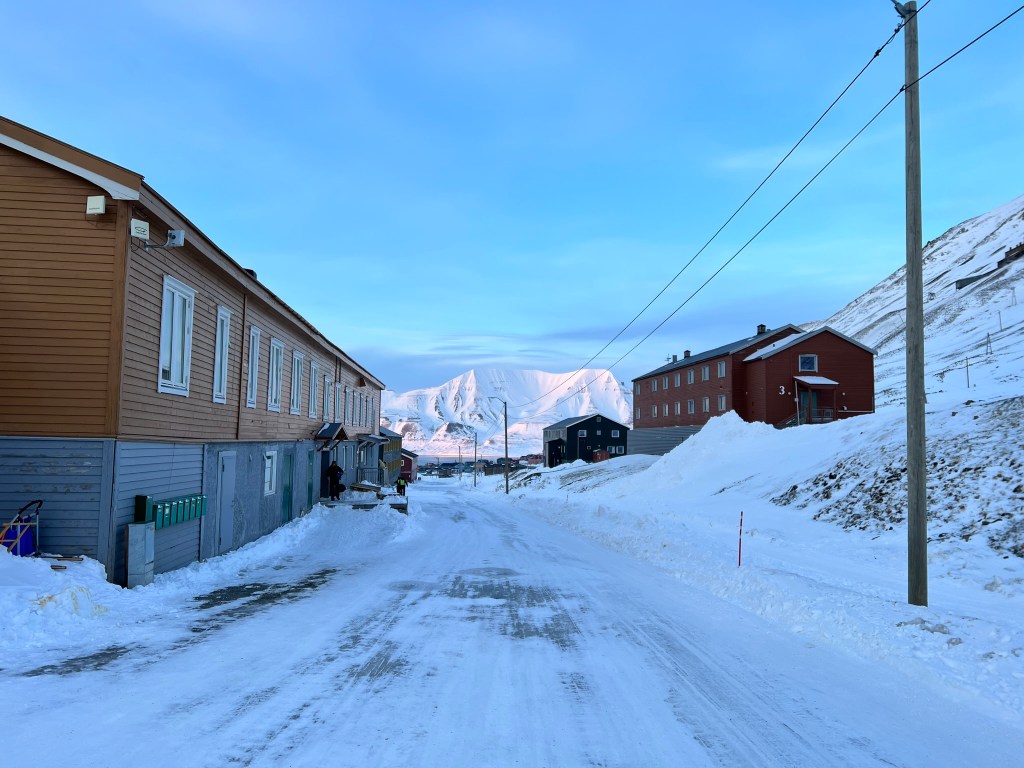
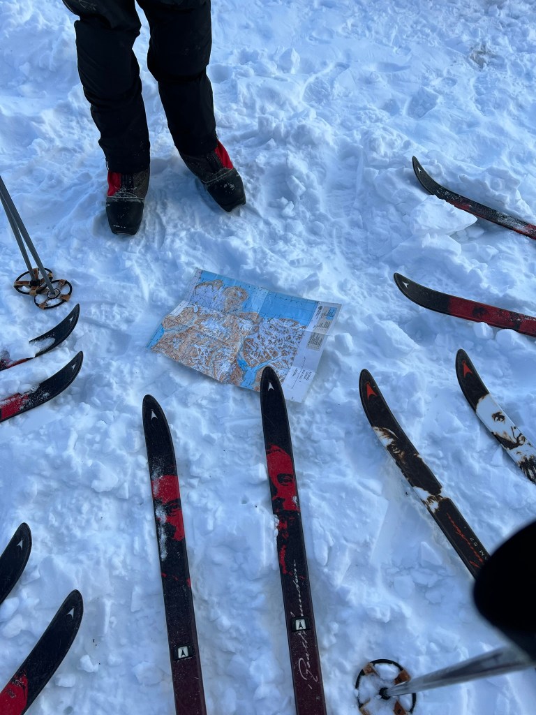
Longyearbyen! This was our base at the start and finish of the expedition, staying at the lovely Gjesthuset 102. Its located in Nybyen “new town” at the far end of the valley close to the glacier. We used the basement of a nearby building to pack our pulkas, which would carry everything we needed to survive for ten days in the arctic wilderness.

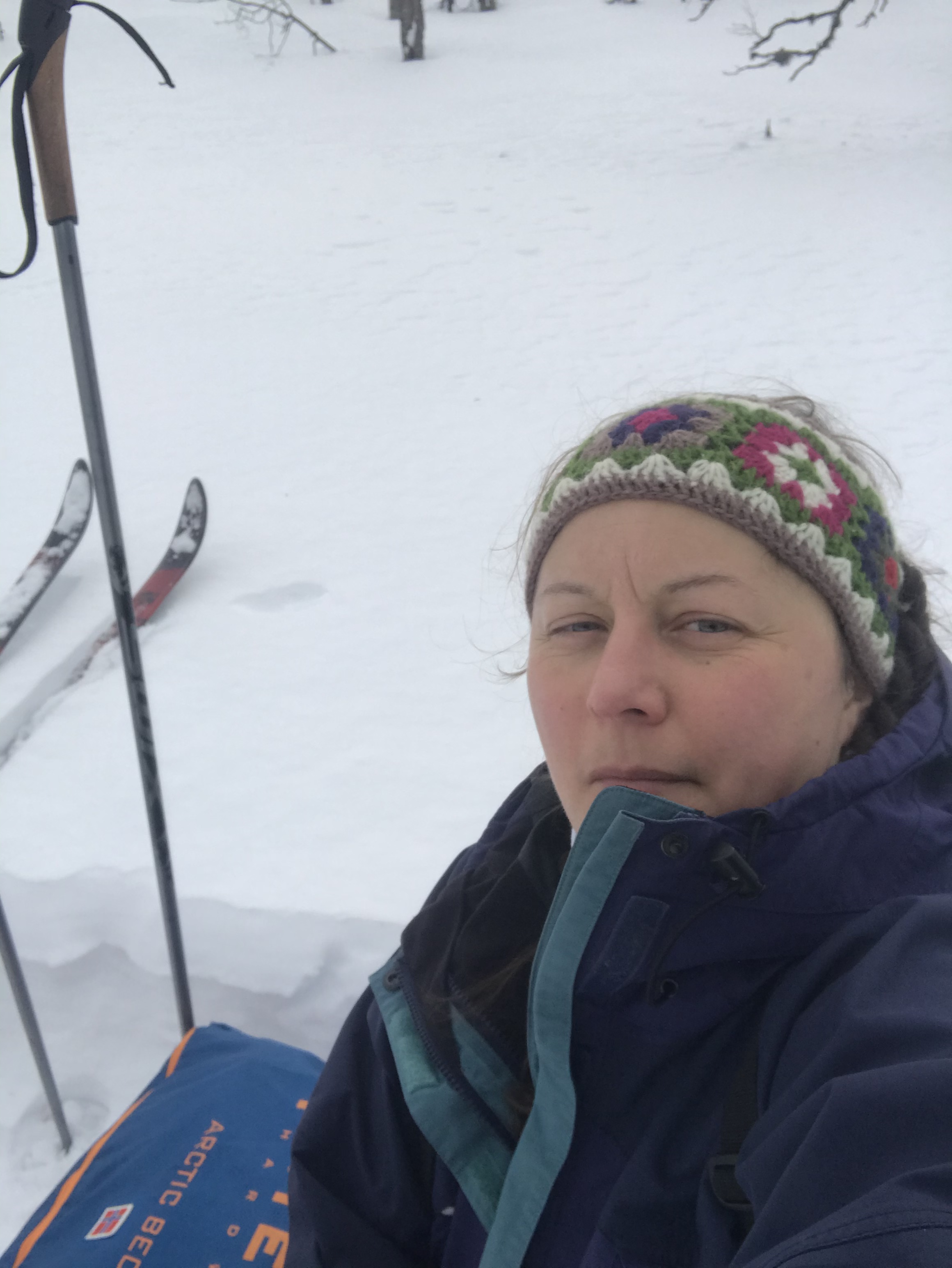
I was lucky to have been to Hardangervidda in February, but some of the team hadn’t skied since 2019 and we all needed to refresh some skills. So after a night in the hostel and and excellent breakfast our guide lead us up onto the glacier for an overnight camp in the moraine. It was a good opportunity to test our kit with enough time for tweaks before we set off on the expedition. It was so good to be back in a tent in the cold!

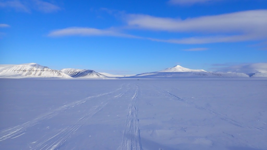
Day 1 Longyearbyen to Agardhdalen

Definitely a few butterflies when I woke up: 2 years of just waiting was over, today was departure day! First up, another excellent hostel breakfast to set us up for the day, a last pulk faff and a short taxi to the snowmobile centre. Here we were kitted up for the three hour ride to the east coast, it would be cold so lots of layers were needed which meant we were a bit toasty waiting inside. Apart from missing quite a bit of the views due to foggy glasses, the ride was ace. We stopped a couple of times to stretch our legs and finally we arrived at Agardhdalen, our starting point.

This was a short day skiing, moving away from the coast and into the moraine under the glacier we were to climb the following day. After a briefing about the protection in place for polar bears (the main one being: we don’t go anywhere near where the bears might be) we had our first expedition night. The adventure had really begun.

Day 2 Agardhdalen to Passbreen

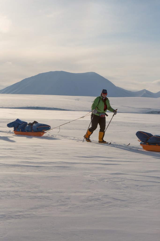
The day of up!  Our morning tent-faff needs some work as we were finally ready to set off by 9:20am.  But ready we were and from our camp in the moraine, this was a day of skiing up almost to the top of the glacier.  For the whole expedition, we were in a routine of either 50/10 or 45/15 sections: ski for 45 or 50 minutes, rest for 15 or 10.  During our breaks, we introduced ourselves to the rest of the group and began to absorb the awesome scenery.

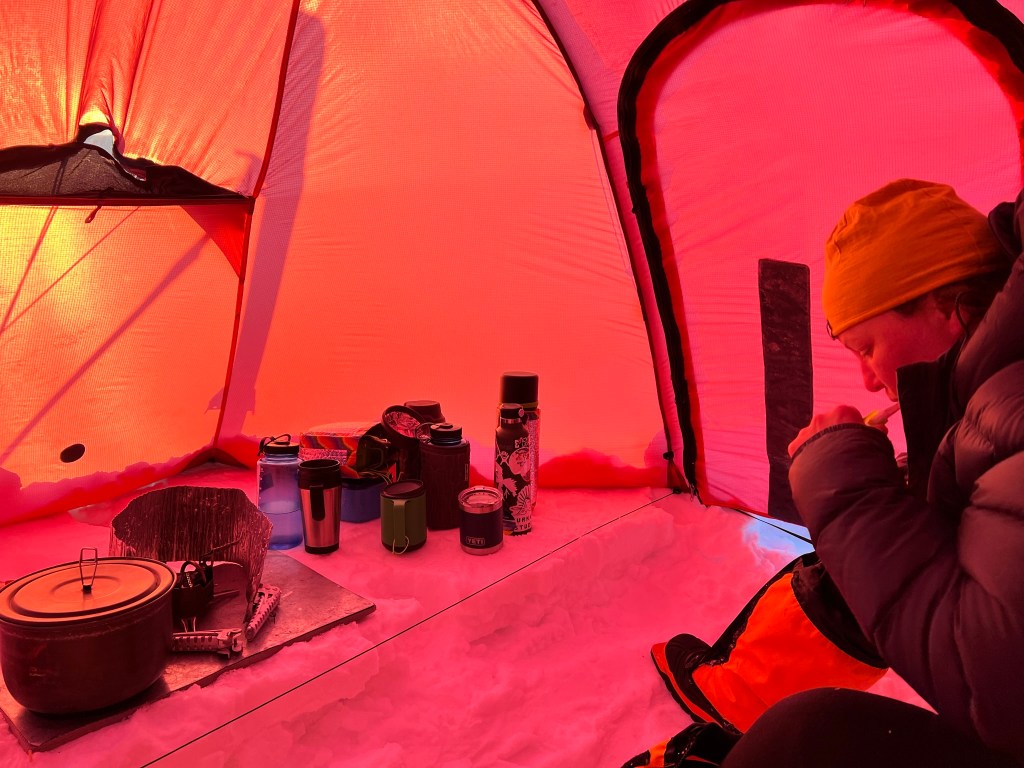
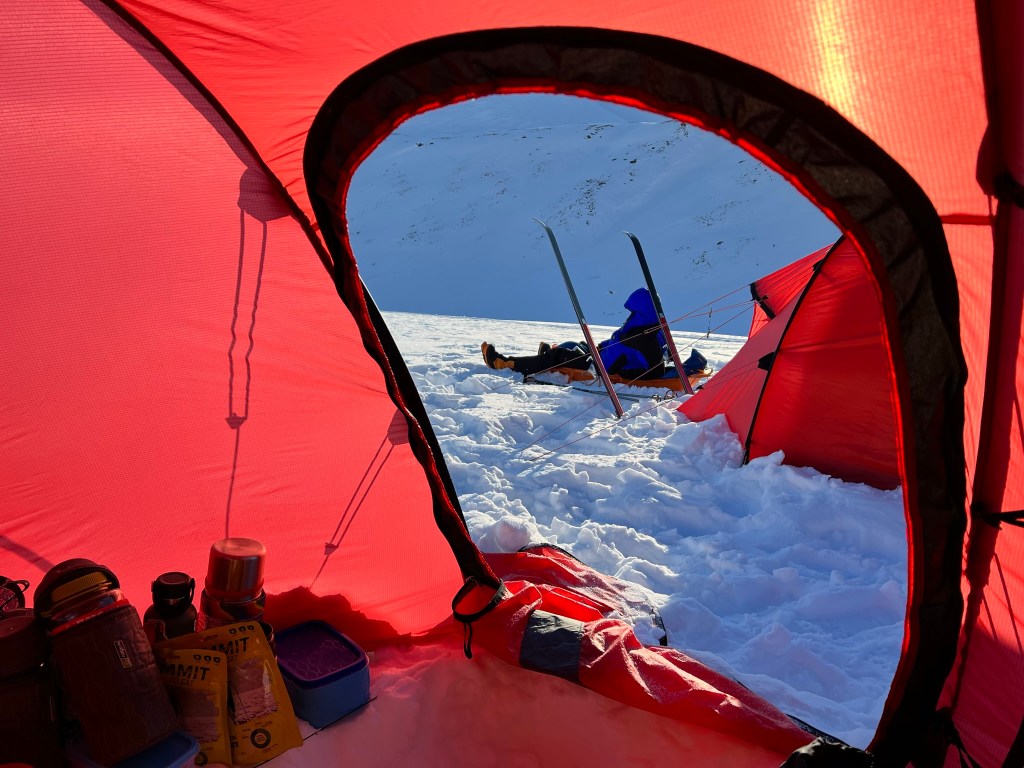
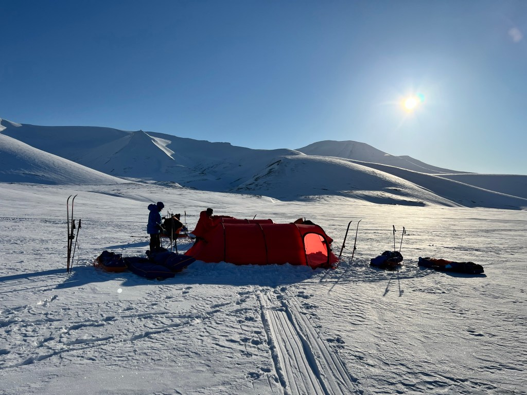
Camp was just below the summit of the glacier, the wind was building and we were less exposed on this side.  So once the tents were pitched, we build snow walls.  Two clearing the soft powdery snow, our guide expertly cutting blocks and the rest of the team building the walls.  It was about -25C, plus wind chill outside, -12C in the tent but we were cozy warm in our sleeping bags, hugging our Nalgene bottles full of hot water.

Day 3 Passbreen to Edvardbreen

And the day of down! The snow walls had done their job but it was still a bit tricky talking the tents down in the wind. After skiing up the last 40 metres to the top of the glacier, it was downhill for the rest of the day. Descending took a combination of easy skiing through powdery snow, inelegant snow-ploughing with the pulk at my side like a badly behaved shetland pony and, most excitingly, taking our skis off and tobogganing down on our pulks.

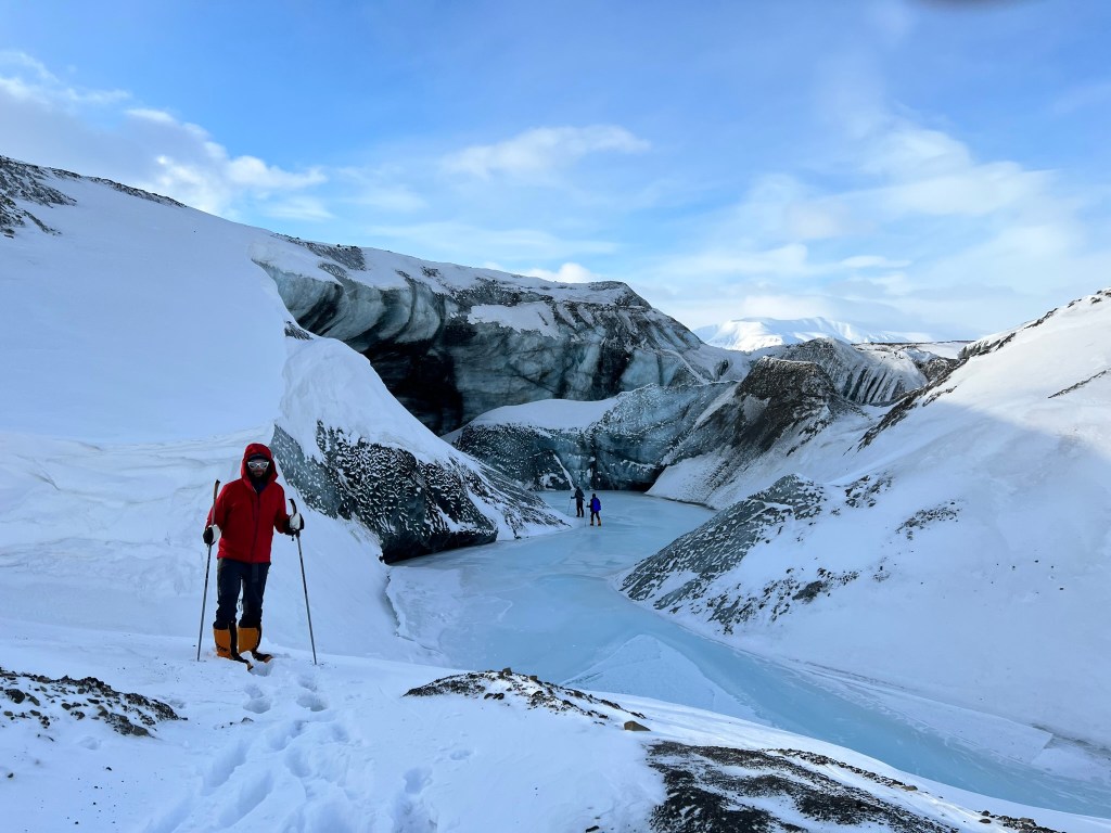
We stopped on Edvardbreen, leaving our pulks to go explore the glacier meltwater channel. More inelegance from me negotiating the channel and we came to the utterly beautiful ice walls. Photos don’t do the colours justice, every shade of blue from inky dark to powder blue.

Day 4 Edvardbreen to Lundströmdalen

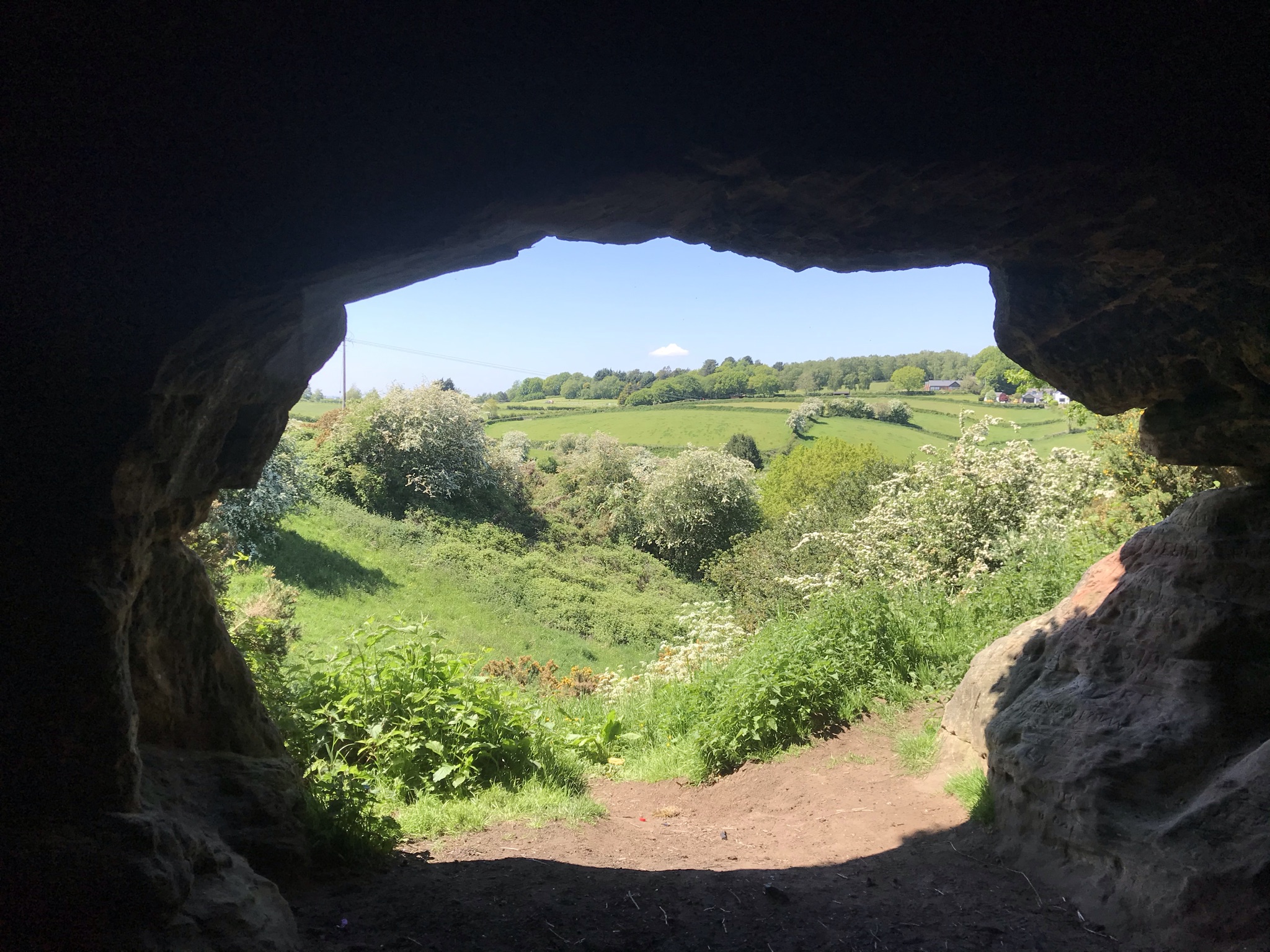
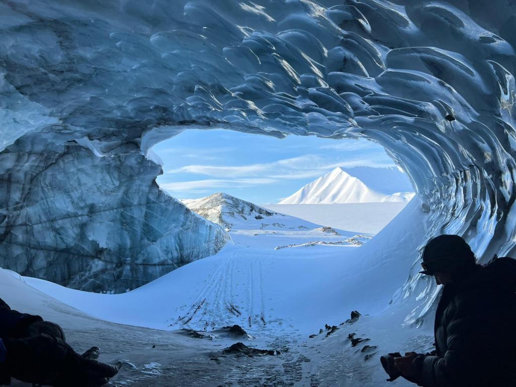
It’s very hard to have just one treasured moment from this expedition, but day 4’s discovery was a strong contender.  Shortly after we broke camp, our guide was looking out for an ice arch that had been further along the meltwater channel we visited the day before.  It had gone but he made an even better discovery: a huge, pristine ice cave.  I love nature at its most dramatic, but I can’t remember the last time I’ve had that sharp-intake-of-breath moment at the sight of something.  It was breathtakingly beautiful.    We spent a good while in the cave, Our guide explaining how they are formed and why the colours are so varied.

We lingered as long as we could, but we needed to keep moving.  We crossed a lake and then the snow covered multitude of streams and rivers that flowed into the Kjellstromdalen.  Much further down the valley is the disused mine Sveagruva, now being cleaned and dismantled.  It was then we came across the first signs of people, a cabin in the distance and then, more abruptly, huge tracks along a track marked out by canes.  Initially a little disappointed that our complete isolation, that was expected to last for at least another day, was over it was fascinating when a lone tracked vehicle came by after we set up camp.  The disruption to our peace was minimal and couldn’t reduce the joy of where we were.

The view from inside the ice cave. On the ceiling, the ice looks polished reflecting the low light. Ski tracks and abandoned skis are in the entrance.
Snow cave!

Day 5 Lundströmdalen to Reindalen

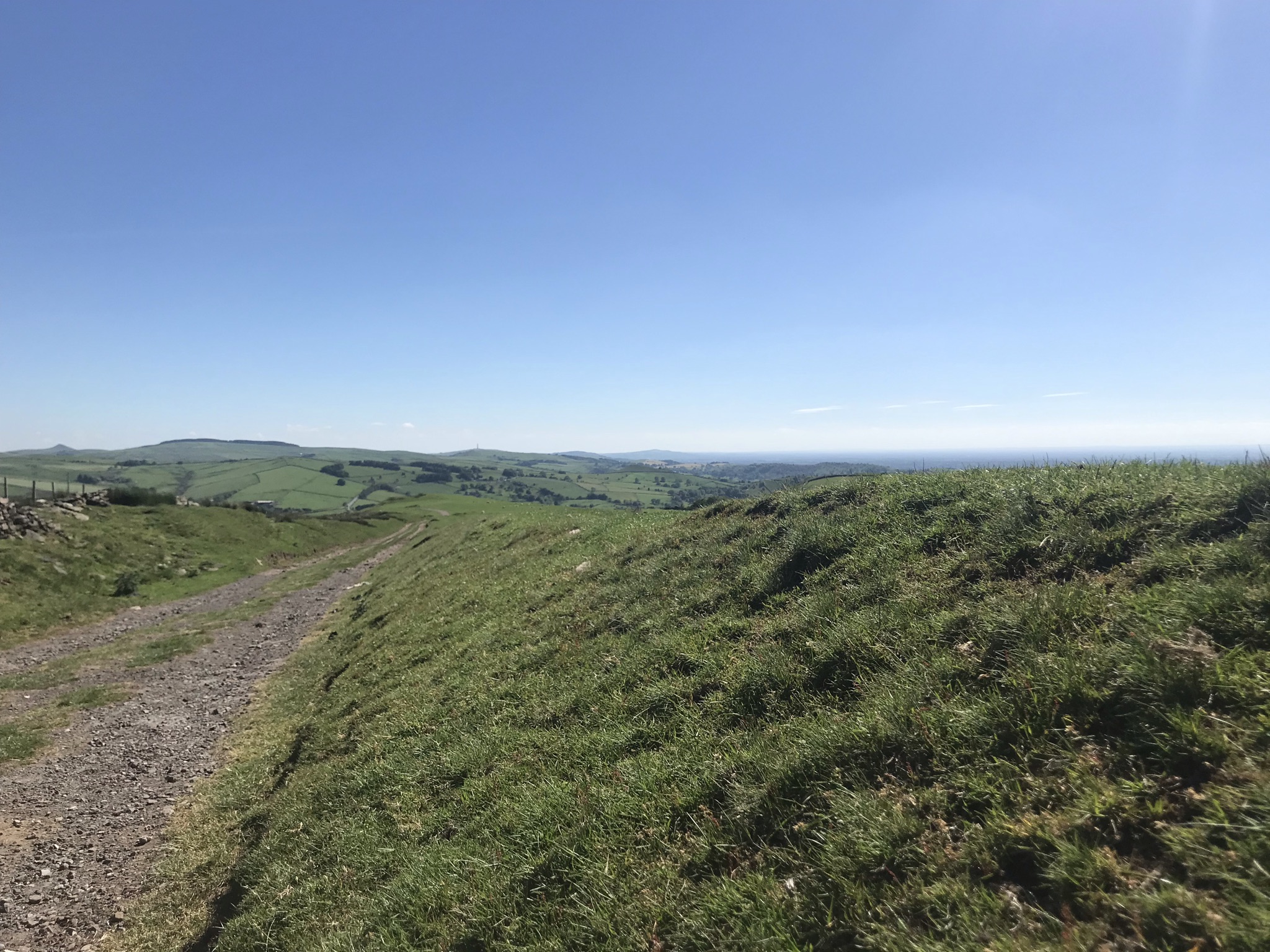
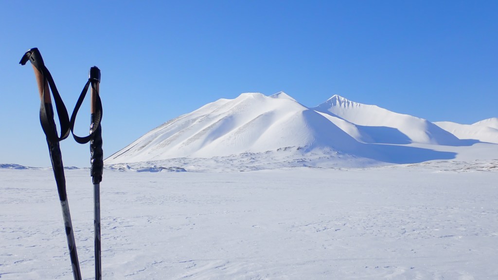
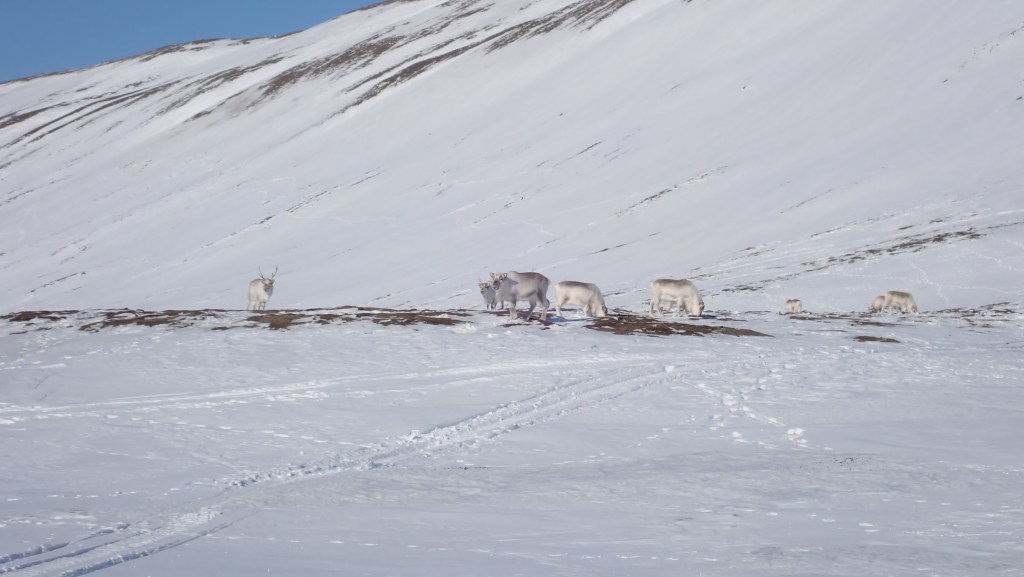
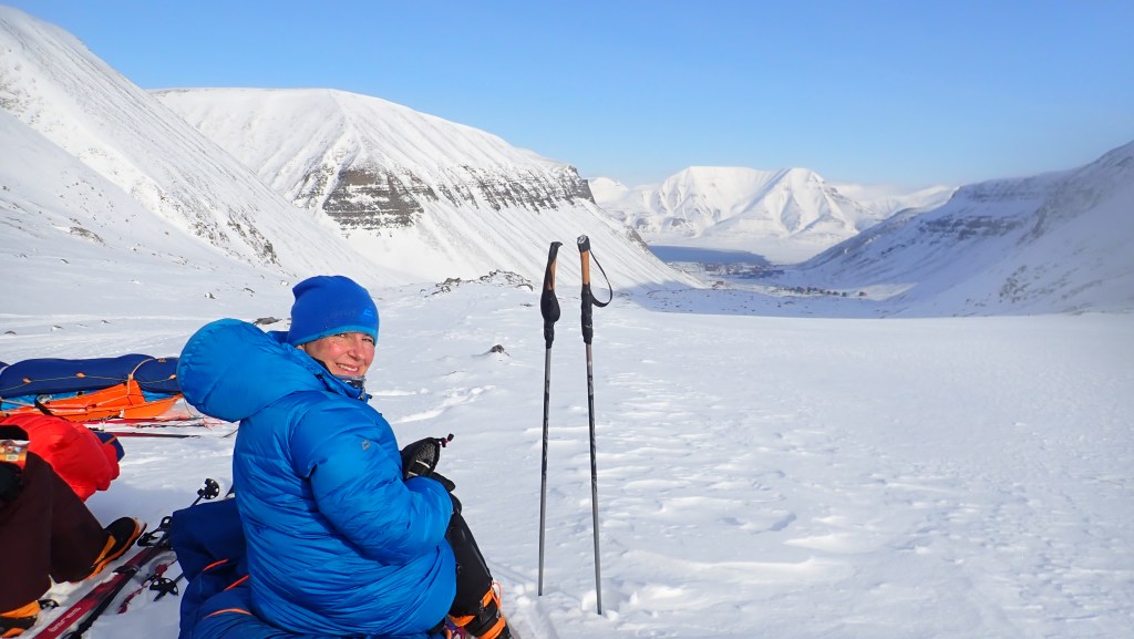
Day 5? How could we be almost halfway through? This was a more steady day, working our way up the Lundströmdalen and into the expansive Reindalen.  There was more wildlife to be seen here, our guide pointing out where Arctic Fox had scent marked, and we sow the fox tracks crossing our path throughout the day.  Ptarmigan strutting on the bare soil, so hard to see let alone photograph, and as we were approaching Reindalen (reindeer valley) more and more reindeer.  We stopped for lunch in the sun and as we skied away we could just see the antennae of a weather station: I half expected to see a tauntaun returning to the rebel base (Star Wars reference, SorryNotSorry)

This was a great day for some thinking time.  The day is driven by routine: once we break camp the day is split into hourly legs of skiing and a break for kit faff, a drink and a snack.  These are usually 50/10 minutes or 45/15 depending on the terrain, weather, mood or distance we need to cover.  While skiing we are usually in a line so for 50 minutes I was alone with my thoughts, and what an awesome place to do some proper thinking!

Day 6 Reindalen

We were woken to the sound of two male Ptarmigan facing each other off right outside our tents.  This was a great way to start what was to be our longest distance skied of the whole expedition and was gently downhill all the way.  Reindalen is huge.  After the narrow valley and glacier passes the view ahead of us was wide and clear, and we would spend the whole day here.  We stopped early on our second leg to visit a Pingo.  Pingos are found in valleys where the permafrost extends up the mountain sides, and there are believed to be around 10,000 of them in total.  They are, for want of a better description, soil ‘volcanoes’ caused by the water table being higher up the mountainside, working its way through cracks in the permafrost and then up through the valley floor.  This one was no longer forming and, when we left our pulks and skis to climb the 30m to the top, it really did look like the caldera of a volcano.

The valley widened and the further down we went, the more and more reindeer we saw.  We also saw more people in the distance, another team skiing in the opposite direction, a couple of dogsled teams and a few snowmobiles.  Fun fact for the engineers – we also saw the largest bulldozer in Norway, making its slow progress all the way to the mine at Sveagruva.

Day 7 Reindalen to Tufsdalen

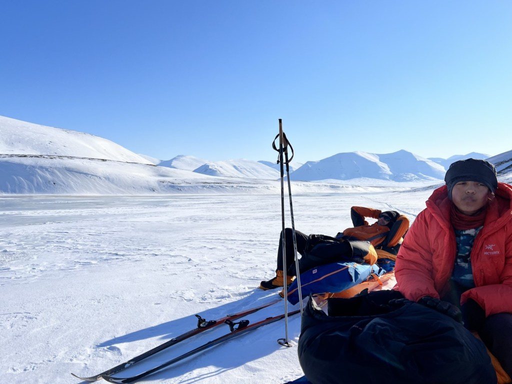
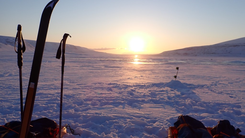
After a really good nights sleep we skied the last stretch of Reindalen for us, as we turned north the valley continues almost as far again to the fjord.  We stopped just out of sight of the Red Cross hut, built as a refuge for miners, on a rise scraped clear of snow and basked in the sun.  We were so lucky with the weather. 

After three days of easy skiing, we had a dash of excitement getting down the steep bank to the frozen river we needed to cross.  The easiest way to deal with the pulks was to unclip them from our harnesses, make sure everything is firmly strapped down and letting them find their own way down.  It became an impromptu game of pulk curling, the aim being to get ours as close to our guide’s pulk as we could.  Smug alert: mine made a bee-line for his and neatly tapped it as it came to a stop.  My skills at pulk-curling was not matched by my decent of the river bank on skis: you can’t have it all.

It was then all about the up again, in powdery snow.  The valley was narrow between steep-sided mountains, stopping just before the col where we dug platforms for the tents in the sunshine.

Day 8 Tufsdalen to Colesdalen

The days started with a very hot and sweaty climb up to the col.  The mountain slopes closed further and further in, with high marks from snowmobile in the snow and the sun disappearing behind the mountains.  The decent followed the path of a frozen stream, as we wound our way down I decide to take off my skis and walk: the chances of the combination of a boulder strewn drop to the stream bed and my inexpert pulk handling resulting in a mess was too high.

As the sun crept behind a mountain again, we packed up from lunch and set off.  The goal was to find a disused fox trap, it was long abandoned possibly for over a century, and having read A Woman in the Polar Night it fascinated me to see it.  But it was covered in snow and hidden from us, so we stopped for a break surrounded by reindeer.  The plan was to have set camp here, it was certainly a great spot, but the snow was too thin so we pressed on. 

Further on the snow was still thin, so we had to cross the frozen river.  This was wider than anything we had crossed before, and with no snow covering it was icy and slippery.  Water and ski skins are a bad combination, so we walked.  Little cracking noises raised the heart rates a tad but scooting along on my pulk, propelling myself with my ski poles was ace.  Camp was found, and with the confidence of a team who have their camp craft well organised, we lounged in the evening sun.

Day 9 Colesdalen to Fardalen

Our last full day on the snow and there were more clouds in the sky.  It was still, as declared by our guide every day so far “a beautiful day!” and though our mood was tinged with sadness that this would soon be over, it really was another beautiful day and after a record speed morning tent faff, we set off.  We crossed the river again, and for the first time we saw an arctic fox.  Our guide spotted fresh tracks and in the very far distance a tiny black dot was moving against the snow.  But it WAS a fox. 

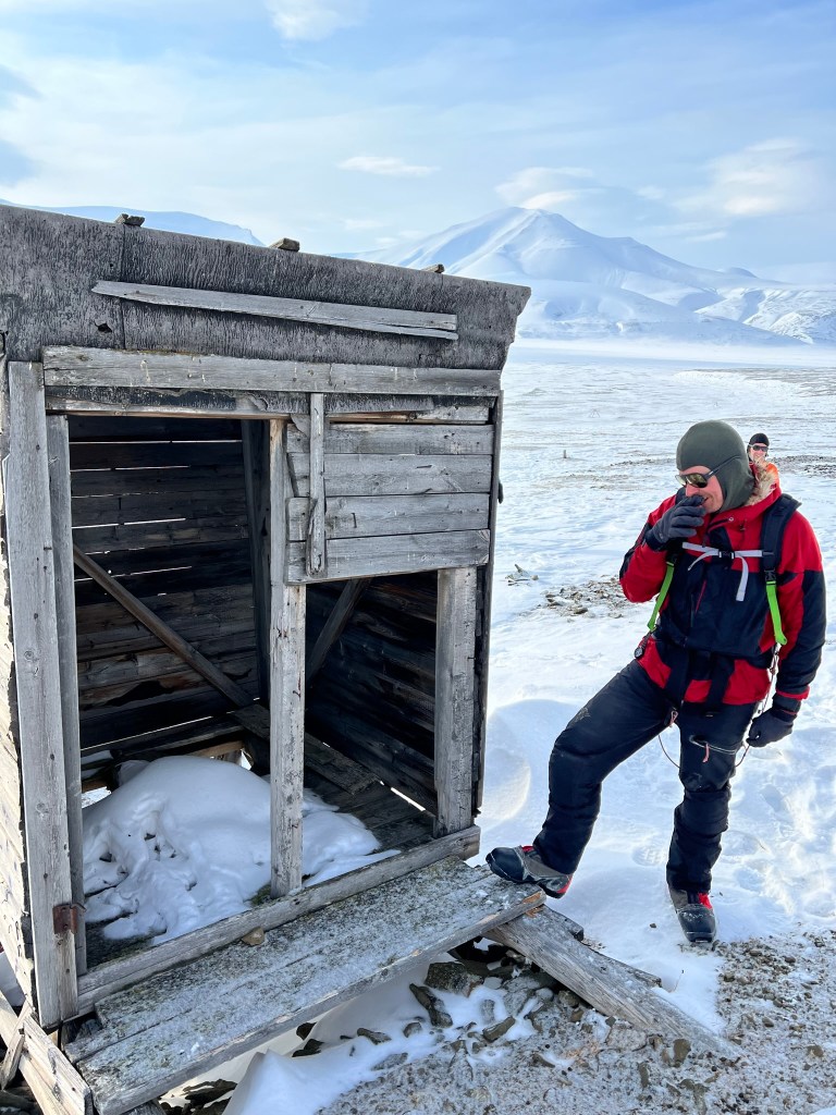
We were near Colesbukta and the abandoned mine, too far for us to visit but we did stop at what would have been an outpost of the mine.  The huts were flattened to the ground, with stove pipes sticking up about the remains.  What was still standing was the toilet hut, with pellet gun holes in the panels from target practice: hopefully not when someone was using the facilities!  

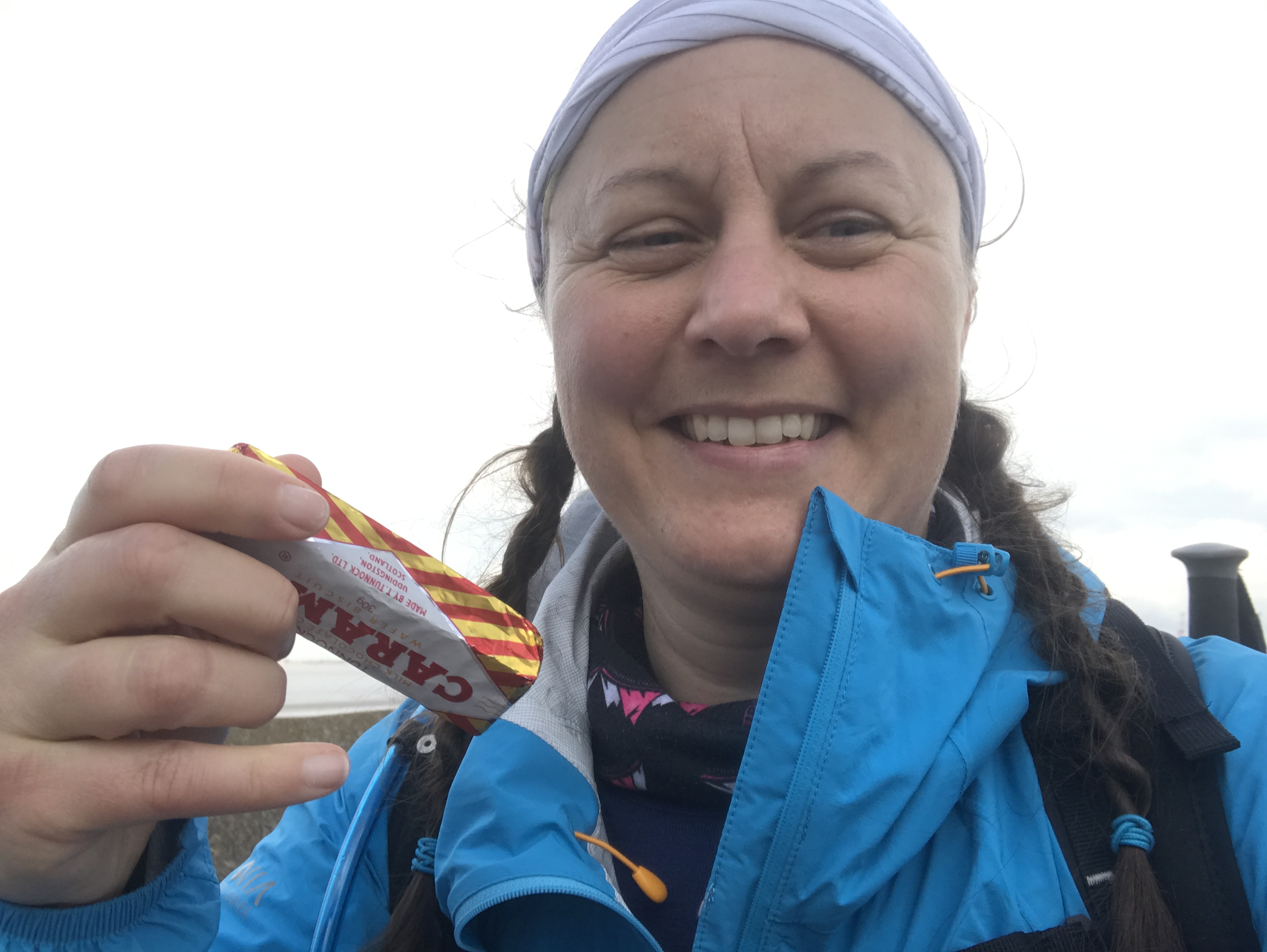
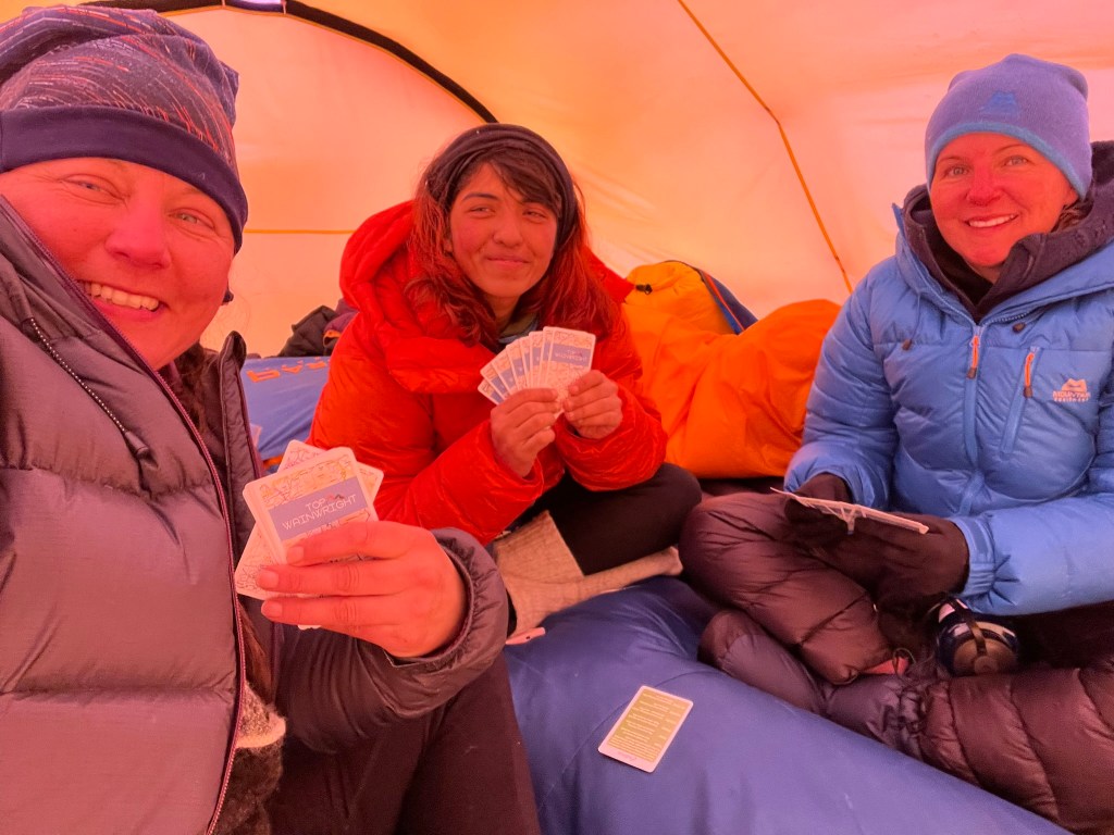
We followed a tributary up the valley, eventually climbing up the bank when gully narrowed and the cornice on the far back was a little too much of a threat.  It was Saturday so there were many more people about on snowmobiles, we were getting very close to Longyearbyen.  We finished early and camped further up the river bed, drinking tea and eating Bixit biscuits sat on the bedding bags.  We even found time for a game of Top Wainwright before settling down to our last night in our little red home.

Day 10 Fardalen to Longyearbyen

I woke before the alarm and lay a while, snug in the sleeping bag with ice crystals from the tent inner lightly falling on my face.  I wanted to stretch out this moment as long as possible, our last day.  But the alarm went and I started the first task of the morning routine: lighting the stove.

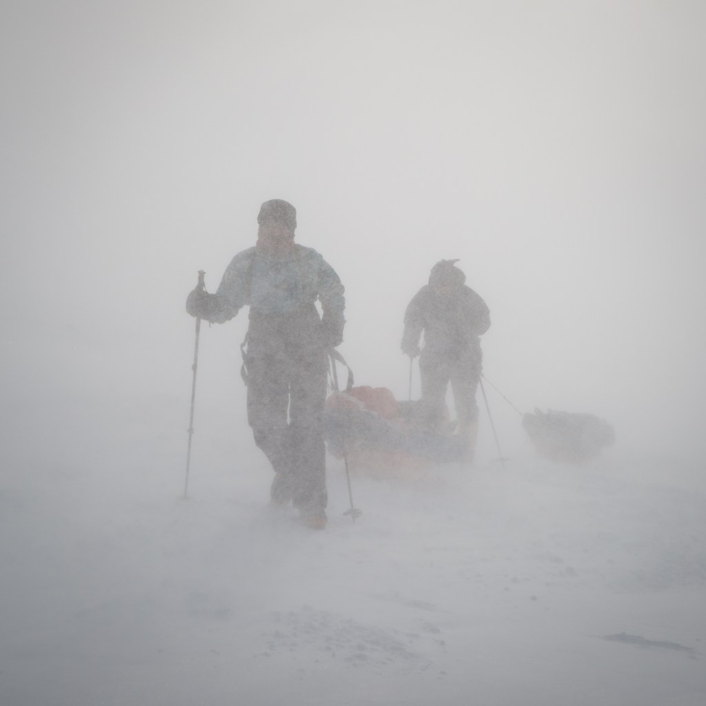
The route started with a very short steep pull out of the river bed which set the tone for the day: short and tough.  We steadily climbed up and up, the aim to keep moving and keep the momentum.  If you stop, the pulka seems to gain 20 kg in weight and it’s hard to get started again.  At the foot of the ‘big climb’ we stopped for a break.  An abandoned snowmobile hinted at what was to come and a little further on we took our skis off to walk the rest of the climb.  To add to the gnarlyness, the wind picked up blowing spindrift in our faces, Svalbard wasn’t going to let us go lightly.  But actually, I quite enjoyed the climb.  I felt strong and capable and just a little bit badass.  We regrouped at the top and then it was all about the down, sometimes skiing sometimes walking we wound our way down the glacier.  Longyearbyen came into view and then suddenly we were back in civilisation.  Helen, the epedition leader greeted us at the lock-up and we all shared hugs, and may be a tear of joy or two.

I’d done it.  Three and a half years after deciding on a cold adventure and two years of just waiting I had finally crossed Svalbard.

Interested in trying your own adventure in cold places? I thoroughly recommend contacting the expedition provider I used: www.newland.no

A hazy view through trees over a distance fields
Cheshire Challenge, Walk

Cheshire Challenge walk 25 – Sandstone Trail

The Sandstone Trail.  Its probably one of (if not the) most well-known long-distance path in Cheshire.  It joins the towns of Frodsham in the north and Whitchurch in the south, 55km (or 54km on the OS route below) broadly following the sandstone ridge.  Most years there are events to walk or run the whole route in a day, long before the Cheshire Challenge became a ‘thing’ I pondered walking the whole route.  Early in the challenge the closeness of the Eddisbury Way, which runs almost parallel to the Sandstone Trail made for convenient and easy circular walks: 1, 5 and 22.  After walking 55km on the relatively flat Wirral Circular Trail I wanted another big endurance challenge and even though it meant repeating sections, walking the Sandstone Trail in a day fitted the bill.

Although the distance is the same, the elevation and terrain certainly isn’t: 495m meters versus 1090m and pavement versus dirt tracks and towpaths.  This makes for an interesting challenge, although the route is tougher the variation is much easier on the feet and legs than pavement-pounding.  And so I made a plan once again with Sarah Williams.

We were dropped off in Whitchurch at just after 7am and after a little faffing to get to the exact start, a sandstone arch on the edge of Jubilee Park, then a little more faffing with the GPS dancing around to find the right path indicated by a small waymark halfway up a lamppost hidden by trees. But we were off and quickly picked up the Whitchurch spur of the Llangollen canal and onto the Llangollen canal heading north.  5.5km along the canal settled us into the walk, then a few steps down at Willeymoor Lock lead across gently rolling fields.  The fields were full of ripening wheat, barley and oats, maize towering over our heads and rich grass.  The trail passes alongside farms and round a racehorse yard, the sandy track neatly raked ready for the day’s training.   The rolling fields came to an end at Bickerton and the steep climb up to the fort, picking up the sandstone ridge.  We had no time to explore on this walk, though there are many fascinating places along the way.  Along the ridge of Bickerton Hill is Mad Allen’s hole, a small cave once occupied by a hermit called John Harris in the late 18th Century.  Its tricky to get to but I may well return for an explore.  Up on the ridge is a memorial and poem to Kitty, the wife of Leslie Wheeldon who helped the National Trust acquire the land.

The path descends steeply before quickly turning back uphill to the high point of the walk at Rawhead.  The weekend we walked was also the weekend of Carfest and as we sat at the trig point for a snack we could hear the engines revving somewhere below us.  Leaving the views across to the Clywds in North Wales the path heads east to Bulkeley Hill and views across the Cheshire plain to the edges of the Peak District.  The air was hazy and despite searching it wasn’t possible to see Croker Hill and the distinctive radio tower from walk 24. 

And now a section of steady downhill as the temperature began to rise, though mercifully cooler than the previous weekend that saw temperatures rise to nearly 30C, far too hot for me: there is a reason I picked a cold adventure!   Now on familiar paths, we passed Beeston Castle and on to Wharton Locks on the Shropshire Union Canal.  Back in August Sarah and I walked this way on our challenge walk of 20 miles (30km), we were pretty broken by the end of that walk and it felt good to have progressed so far with our endurance fitness.  We stopped at the lock for another snack and to rest from the heat before setting out again across the open fields.

As we reached Gresty’s waste, we ran out of water.  With many miles to go and nowhere for a top up before Frodsham on the route, I phoned home for assistance.  Another 1.5 litres in the pack and we were good to go.  Delamere Forest is my extended back garden, so we were able to pick up a pace on good and familiar paths.  I have walked the section of the Sandstone trail to Frodsham from Delamere several times, this was intentional planning as we didn’t need to stop to check the map.  Just before the ridgeway, I got out my headtorch.  From now the route winds through woodland and with the sun setting the light was fading fast.  I like walking in the dark, with my whole world reduced to a patch of light in front of me.  Frodsham woods are full of sandstone outcrops, quarries and steep hillsides so great care was needed amongst the tree roots.  The sound of a wedding party at the Forest Hills hotel contradicted the winding path through the trees before we popped out into the open and night time views across Wirral.  The final winding path dropping out of the woods into Frodsham was welcome and with the pubs bustling with Saturday night drinkers, we hugged the pillar outside the Bear pub that marks the end of the trail.  15 hours 40 minutes and, though tired, we felt pleasantly strong with only a few minor complaints from weary feet and knees.

Video of the walk HERE

The route is available on the Ordnance Survey website HERE

Cheshire Challenge distance*39.9km
Paths walkedSandstone Trail
Total distance53.8km
Total ascent1090m
OS mapExplorer 257, 267
Date walkedJuly 2021
Time taken15 hours 40 mins
CakeSponge – but we were too tired and forgot!
Dance poseShowtime
Total Cheshire Challenge distance completed:482km (1500km total)
the stats

*not including previously logged walks on the Sandstone Trail

A drystone wall in front of a field of long grass. In the distance is a flat plain of fields and trees with a small reservoir.
Cheshire Challenge, Walk

Cheshire Challenge walk 24 – Cheshire Ring Canal Walk, Dane Valley Way & Gritstone Trail

Ah summer weather in Britain.  All week beforehand the various forecasts had shown it was going to be a very wet walk, but as Sarah and I got in the car the forecasts changed and the rain disappeared.  This meant I wasn’t quite carrying the right kit; I had my heavier waterproofs but no sun protection or hat.  I’m normally more cautious in my packing so this was a gentle reminder not to get complacent.

As with walk 23, this started in Bollington but this time headed south on the canal towards Macclesfield after once again climbing the seemingly vertical steps up from the road.  The navigation for the first 15km was to simply follow the canal and we set off at a good pace catching up on our various plans, training and what snacks we had bought with us.   Our conversation was interrupted as we walked through Macclesfield by a closed section of the towpath.  Again I kicked myself for not checking with the Canal and River Trust website but it looked like people had been walking past the fencing so, feeling thoroughly rebellious we carried on.  I thought our plan had been scuppered as we came across the blockage, a collapsed retaining wall just before the diversion re-joined the towpath, but we pulled on our brave-pants and scrambled round.  It was naughty and we shouldn’t have done it, but I really didn’t want to leave a mere 300 meters of path I’d have to drive all the way to Macclesfield to walk.  We skipped on quickly and soon our misdemeanour was forgotten.

The canal side was in full summer bloom, flocks of Canada geese were lazing on the water and the sun was warm in a brilliant blue sky.  We stopped for snacks before passing a familiar narrowboat.  We saw Third Time Lucky walking north along the canal in the previous walk, at the time I still didn’t know if the twice-cancelled expedition to Svalbard would be going ahead in 2022 but, just the week before, I’d had confirmation that it was on.  So thank you Third Time Lucky for being a good omen!  After crossing the river Dane on a high aqueduct, it was time to leave the canal and walk a very short stretch of the Dane Valley Way before climbing hard to the highest point of the walk.  With the temperature creeping up an unexpectedly boggy section resulted in wet feet and very nearly soggy bottoms as well, but fast reactions and a few shrieks of laugher we leapt the worst bits and hoped our socks would dry.  I suppose it was expected given I was wearing my new walking shoes and we dried out walking along the good tracks along the ridge of Minn-End-Lane.

Croker Hill has a large radio mast on the summit which on a clear day can be seen all the way west on the Sandstone Trail.  I read a lot about the kindness of strangers while out on adventures, and eternal thanks goes to the guy fixing a barn roof who bought us water when we asked if we could use an outside tap.  Following behind us were two women training for the Gritstone Grind later in the year who were equally grateful for a top up of their bottles.  After the summit of Croker Hill, the path rolled along before dropping down to the reservoirs of Ridgegate, Bottoms and Teggsnose.  The second big climb of the walk from Teggsnose reservoir to the summit of Tegg’s Nose was through woods and the delightfully named Ward’s Knob.  Brightly painted historical quarry machinery lined the path as we dropped down before a final sting of steep climb back up to Kerridge Hill.  Here the route left the Gritstone Trail and, following the same path as the previous walk, we walked back along the canal and to the cake that awaited us in the van.

Video of the walk HERE

The route is available on the Ordnance Survey website HERE

Cheshire Challenge distance30.6km
Paths walkedCheshire Ring Canal Walk, Dane Valley Way & Gritstone Trail
Total distance40.4km
Total ascent1003m
OS mapExplorer 268
Date walkedJuly 2021
Time taken12 hours
CakeCherry Cake (again!)
Dance poseGeneral silliness
Total Cheshire Challenge distance completed442.3km (1500km total)
the stats
Journey to Svalbard

Third time lucky?

The 2022 Svalbard crossing expedition is on.  The sabbatical is booked.  I’ve blown the dust of the kit checklist and done several happy-dances round the house.  After two cancellations, I’m remaining cautiously optimistic and I do need to have a defined Plan B if it cancels again: mostly around what I do with the sabbatical.  But that planning is for later.  My attention is now on being ready for April 2022.

In July 2019 I ran/walked the Thunder Run, a 24 hour relay race around a 10km trail in Catton Park in Derbyshire, UK.  I completed 4 laps for my team and felt pretty good about it, and by April 2020 I was ready for the Svalbard Crossing.  Fast forward to now and I can walk 55km in 12 hours so I am much fitter this time round with 9 months to go.  That being said, I am the queen of self-doubt and I am definitely not in as good a place mentally as I was in July 2019. This is hardly surprising but I know that over and above physical training, I need to focus on training my mindset. This is supposed to be fun, after all!

So what does this mean for the Cheshire Challenge?  Next weekend I will clock round my target of 30% complete this year, 50% feels way off but maybe 42%?  I’m going to press pause on the challenge for a few months over winter, the Cheshire plains will turn into a clarty horrible mud-fest and I desperately want some winter mountain time.  So 42% by November?  That feels like a good number.

Onward!

Clear blue sky above a stony track heading gently down hill between soft grassy banks. Hill can be seen on the horizon
Cheshire Challenge, Walk

Cheshire Challenge walk 23 – Cheshire Ring Canal Walk, North Cheshire Way and Gritstone Trail

Although this was not the longest walk so far in the Cheshire Challenge (that title is currently held by walk 21), this one scores high on the toughness scale; the eastern side of Cheshire rises up to the Peak District so it’s no surprise this 30km walk has the highest point (412m) and most ascent (814m) of the walks in the challenge so far.  In fact its over double the previous highest point of 172m on the Eddisbury Way.  I’ve also hit the milestone of walking 205km this year, the same as 2020 and climbed over 6000 meters over the whole challenge so far.  I am terrible for not celebrating my successes, but I think if I’d been told last year I would have achieved this I would not have believed it.

This walk started in Bollington and the mood was set climbing up the very steep Hole I’ th’ Wall steps leading up to the aqueduct on the Macclesfield Canal.  A quick stretching session to get the legs going and Sarah and I set off along the towpath.  This was an easy 5km to lull our legs into a false sense of security before we left the canal for the North Cheshire Way.  The North Cheshire Way stretches from Hooton station some 113km to Disley station and this walk would bring me close to the halfway compete mark.  The path lead through delightful flower meadows buzzing with bees, butterflies and beetles.  We stopped surrounded by buttercups for a snack before the walk pulled steadily upwards and into rougher hillier countryside.  Our attention was grabbed by shearers working in a field next to the drystone wall bordered track.  The speed at which each sheep was caught, clipped and released was impressive, with the neatly shorn sheep trotting off to graze unfazed but significantly cooler on a hot day.

My heart skipped in delight at being in this upland countryside again, I miss it and I want to get back to it.  As much as I am enjoying this Challenge, I think I’ll take a winter break when the low land fields turn to a clarty miserable mess and instead head for the mountains and moorlands.

The route follows drystone walls before dropping steadily back off the hills.  Here a dilemma arises.  The North Cheshire Way splits into two options, one that stays low hugging the base of the hills or one that climbs back up to the National Trust Lyme Park.  Both are officially the North Cheshire Way, so do I have to do both?  Saving the conundrum for another day, I had opted for the hillier route, so we climbed steadily up on good paths through woodland with the last of the wild garlic filling the air.

Lyme Park was everything you’d expect from a big National Trust stately home on a sunny day, neat carparks and paths, mown grass full of picnickers, refreshment kiosks and perfectly manicured gardens.  Stopping only briefly for a photo, we set off up Cage Hill with the requisite folly at the top which rewarded us with big views over Manchester and almost all the way to North Wales.  Another steady down hill section past red deer and through large gates completed the experience.  Being a stickler for accuracy, I made us walk down the steps to Disley station to the end of the North Cheshire Way before turning round and starting the Gritstone Trail.  The Gritstone trail is twinned with the Sandstone Trail, it runs sort of parallel-ish on the eastern limits of Cheshire and is only 5 km longer, I’ll be walking a fair stretch of it to train for walking the Sandstone Trail in a day next month.

Walking gently up bridleways to a rickety brick bridge with a safer timber bridge alongside, the Gritstone Trail also splits, one option heading down to Lyme Park and a second staying higher.  It was here I made a major navigation error, or rather didn’t check the automatically generated ‘snap to path’ feature on the OS website.  I didn’t spot that the route I was following up to the road was not the Gritstone Trail, rushing to get ready the evening before I didn’t see the error and by the time I got the ‘this does not feel right’ feeling we were too far up the road to want to turn back.  So I have an orphan path to walk – though with both the Gritstone Trail and North Cheshire Way having alternative routes I can make a decent walk of it.  Hey ho!  The two options for the Gritstone Trail rejoined at the carved anglian crosses known as the bow stones.  Dating from the 8th to 10th century these crossed served many purposes as boundary posts, way markers or places of worship.

From here the path up to the highest point on the walk is on a wide windswept hill with sheep grazing and broken drystone walls providing little protection, fine on a clear day but prime territory for horizontal rain in winter.  A detour for trig baggers can be made here at Sponds Hill, but I was in heads-down mode to catch up on time.  We stopped at the viewpoint at the highest point and even with an afternoon haze to the air I could pick out the Sandstone ridge and North Wales across the plains of Cheshire.  A steady down hill 5km, with the Matterhorn-esque Shutlingsloe prominent in the distance, brought us to the foot of the big pull of the day – White Nancy

White Nancy is the name of the conical folly on Kerridge above Bollington. It was built to commemorate the battle of Waterloo and over the years has been painted to observe many different events from a red poppy to the Olympic rings.  Approaching it from the north on the Gritstone Trail means gaining 100 metres height in an 800 metre distance, all that leg work in training sessions paid off and we managed to climb it in one hit; albeit with hearts pounding and legs complaining bitterly.  Though its possible to miss it out and walk back to Bollington the view is worth the effort.  A kilometre further along the Saddle of Kerridge this walk and the Gritstone Trail parted company and good footpaths lead back to the canal.  Retracing our steps down the Hole I’ th’ Wall steps was the final test for our legs but the reward of cake more than made up for it.

Video of the walk HERE

The route is available on the Ordnance Survey website HERE

Cheshire Challenge Distance27km
Paths walkedCheshire Ring Canal Walk, North Cheshire Way and Gritstone Trail
Total distance30km
Total ascent814m
OS mapOS Explorer OL1 and 268
Date walkedJune 2021
Time taken8 hours 20 minutes
CakeCherry sponge
Dance poseMore 90’s rave classic moves – stack those shelves!
Total Cheshire Challenge distance complete:412km (1500km total)
Rolling fields and Hawthorn bushes covered in white flowers frames by the entrance to a cave
Cheshire Challenge, Walk

Cheshire Challenge walk 22 – North Cheshire Way, Sandstone Trail and Weaver Way

After our big walk, this was to be a nice short 20km.  Huh, never thought I’d write that a few months ago! 

The walk picks up a section of the North Cheshire Way, Sandstone Trail and a little of the Weaver Way.  This corner of Cheshire around Frodsham and Helsby has quite a few overlapping paths which makes the route planning a bit tricky and a minor detour was needed so I could fully tick off a section of the North Cheshire Way.

We started at Frodsham station, the route is a wiggly circular taking in the sandstone ridge with big views over the Mersey and a section along the river Weaver which was engineered to be navigable in 1732.  The weather was gloriously sunny so I bravely left my waterproof trousers at home and took sunscreen and a hat instead.  Leaving kit behind always makes me a tad nervous, especially waterproofs even though the forecast was sunny all day and I was such a short distance from home rescue was only a call away; but nervousness is a good prompt to make me check if I am really sure I should leave something behind or not.

Leaving the station, the route walk hugs the bottom of the ridge, slowly climbing up through the trees.  It’s a very pretty place to walk and lovely to explore the many paths among the broadleaf woods and sandstone outcrops some with ornately carved graffiti from over a century ago.

But we were on a mission and joined the North Cheshire Way at an impressively solid flight of stone steps.  The route continues to hug the wooded hillside for a couple of kilometres then pops back out into the sunshine heading for Helsby.  After a steep climb through more woods, we came to the top of the cliffs above Helsby.  A haunt of local climbers, its often soft, friable sandstone is not to be underestimated and requires significant brave-pants to be worn on the harder grades.

At the top of Helsby hill is a trig, which we visited on walk 6 so we gave it another hug (all trigs need a hug) and stopped for a snack.  The North Cheshire Way now follows the same tracks as the Longster Trail for a few hundred metres before heading south and on paths I have already logged in the challenge.  A very short stretch on the Longster Trail, again already logged, and the route switches to follow the track of the Sandstone Trail.  The strategically placed Spirit of the Herd pony sanctuary’s cake stall was too much temptation to resist and having discussed in depth our plans to eat a little better on our walks we stuffed our selves with fudge and brownies.  Well its for a good cause and very delicious.

The Sandstone Trail is one of, if not the best waymarked path so far on the challenge and the map was forgotten until we got to Baker’s Dozen, a flight of steel steps from Dunsdale Hollow which replaced the very worn Jacob’s ladder steps carved into the sandstone.  It was here we took a short detour to pick up the North Cheshire Way before retracing our steps under the cliffs covered in carved graffiti, some dating back hundreds of years.  Now officially counting towards the North Cheshire Way, the route popped out at the memorial high above Frodsham with more long views to North Wales and Liverpool.

Now the walk headed down off the ridge and into lush meadows and arable fields before arriving at the banks of the river Weaver.  Canada geese, moorhens and mallard ducks were abundant in the reeds in the banks and a long-abandoned lock.  At the road bridge we headed back into town and ate even more cake sat in the sun.  Perfect!

Video of the walk HERE

The route is available on the Ordnance Survey website HERE

Cheshire Challenge distance15.8km
Path walkedNorth Cheshire Way, Sandstone Trail and Weaver Way
Total distance20km
Total ascent609m
OS mapOS Explorer 267
Date walkedMay 2021
Time taken6 hours 20 minutes
CakeKit Kat blondie from Spirit of the Herd AND cherry sponge cake!
Dance pose90’s rave…
Total Cheshire Challenge distance completed:385km (1500km total)
The stats
The brightly painted Mersey Ferry with Liverpool city in the distance
Cheshire Challenge, Walk

Cheshire Challenge walk 21 – Wirral Circular Trail

Blimey that was pretty epic!  This walk was a 12-hour challenge with Sarah Williams: how far could we walk in 12 hours?  Walks 19 and 20 were training walks and I’d set myself a goal of 40km, or even better 42.2km to make a marathon distance.  Well we smashed that!  53km.  Fifty-three.  Fifty blumin’ three!   Very, VERY chuffed with that!

I chose the Wirral Circular Trail at 59km as ‘too long to do in one go’ so we’d not run out of path and the navigation should be fairly easy and not require lots of map checking.  We set off from Hoylake at just after 6am, walking down to the beach and along the shoreline to West Kirby.  The skies were grey with the threat of rain and the tide almost fully out beyond the Hilbre Island.  With just a few dog walkers and one lone early morning litter-picker we had the place to ourselves.  At West Kirby we picked up the Wirral Way, a 19km path along a disused railway line that runs all the way to Hooton with frequent views over the Dee estuary to North Wales, this got us off to a good start: our pace was quick but steady and the kilometres quickly clocked by.   The North Cheshire Way and Arrowe Park to Parkgate Circular follows a section of the Wirral Way, which in itself is a Cheshire Challenge path so this was the third of four times I will walk all or part of the Wirral Way.  It’s a good job it’s a nice route!

If I don’t plan properly, I am quite bad at keeping myself fuelled properly on long days out, so this time Sarah set an alarm to go off every hour to remind us to have a snack, apart from flattening her phone battery this worked really well and it was only at the end of the walk I began to feel really tired.  This is a habit I need to build for Svalbard as eating regularly will be the key to getting the high calories I need for the exertion and cold exposure.

Once at Hooton we took advantage of the train station toilets for a tactical wee, with covid restrictions still in place our options could be limited.  Planning ahead for these things is often the difference between a pleasant walk and a miserable one…  I also needed to tape my feet, my old faithful Keen shoes were finally giving up and I could feel a couple of hotspots developing.  Its always sensible to stop and deal with hotspots as soon as they start as a small bit of tape can be all that’s needed to stop a blister forming, which was the case for me.  The next section is through the residential areas of Eastham, winding round housing estates after walking through the graffiti covered motorway underpass.   The Wirral Circular Trail is reasonably well waymarked but a few rogue signs pointing the wrong way require attention to be paid to the map until the route reaches the promenades along the Mersey.

We stopped for a more substantial snack under a beech tree in Eastham Country Park, with the rain now thoroughly set in we needed to keep moving so as not to get too cold and require faffing with layers so we ate what we could and set off again quickly.  At Eastham Ferry we got our first sight of Liverpool as the route headed north and to the industrial side of Wirral.  The section to Seacombe flits between riverside parks, housing estates, docks and more than a handful of grey industrial units.  Its not pretty and in some places it’s pretty grim, but there’s enough to be interesting. 

At Seacombe the route joins the promenades.  Lots of investment here has created wide, smooth surfaced walkways and cycle paths with views back to Liverpool, the docks on the far side of the Mersey and across to Crosby.  The downside was the hard surface was tough on tired feed and by New Brighton our pace had finally slowed.  As we left New Brighton large foreboding patches of rain could be seen far in the distance along the Welsh coast.  As we walked, the wind turbines disappeared row by row as the rain approached, thunder and then hail.  Well, it wouldn’t be a proper walk if we didn’t get soaked just before the end, would it?

Video of the walk HERE

The route is available on the Ordnance Survey website HERE

Cheshire Challenge distance53km
Paths walkedWirral Circular Trail
Total distance53km
Total ascent495m
OS mapOS 266
Date walkedMay 2021
Time taken12 hours
CakeSarah’s amazing Chocolate cake!
Dance poseAfter 53km, not a chance!
Total Cheshire Challenge distance completed:369km (1500km in total)
The stats
A black and white pub with two scarecrows on a bike outside.
Cheshire Challenge, Walk

Cheshire Challenge walk 20 – Arrowe Park to Parkgate Circular

A week after the Shropshire Union Canal and North Cheshire Way (walk 19), this was another 30km (by the time you add in some faffing) and ticked of 20% of the challenge completed.  It’s also the third completed path and the second walk that completed a whole Cheshire Challenge route in one go, after the Baker Way.   When I drew it out on the big map it seemed huge and daunting but now 30km feels like a ‘good long walk’.  Progress!

We met in the carpark that serves the pub and golf course as well as the park and headed straight out.  I was sloppier than usual in my pre-walk checks and didn’t check my shoes were laced well: my feet suffered later from moving too much inside my shoes and I got my first hot spot on my heel for years.  Lesson learnt.  The weather was sunny and bright for the most part but in the shade and breeze it was sharply cool which required a few layers change over the day.

The walk is mostly well waymarked though a few navigation points were a little tricky to find, the path is not named on the Ordnance Survey maps so this was a walk to have the route marked out on the app or have the guide to hand.  The guide gives a number of alternative routes, the version I opted for seemed the right mix of distance and good paths.

The ground was dried rock hard in the fields and made for tricky terrain where the cows had churned up previously deep mud, but the need to concentrate on our feet didn’t limit the conversation and once again I think we talked almost the whole way round.  This was a rural contrast to walk 19, the most urban it got was crossing the M53 twice and through the middle of Heswall but neither could be described as industrial.  At Brimstage there is the slightly odd sight of a WW2 pill box, there are quite a large number of them around Wirral; with the Dee and Mersey estuaries either side it was seen as a possible invasion site.  This one is bricked up though a few had been broken so carefully (and without dropping our phones) we used the light to peer in and were rewarded with nothing more exciting than litter.

A different mark upon the countryside is the wide, straight, tree-lined ‘roads’ that cross each other and even form a ‘roundabout’ that run from Thornton Hough and Thornton Manor.  I think (though a cursory search on t’internet was inconclusive) these are where Lord Leverhulme started to work on a second Port Sunlight style village.  Most are not public rights of way so access is not permitted but it was fascinating crossing them on the footpaths and wondering what it would have been like if the project was ever finished.

Once through the very chocolate-box pretty Thornton Hough, the route follows a permissive path.  Its not marked on the map – some permissive paths are an orange dashed line – so we marched purposefully across the sports field full of football players hoping we weren’t going to have to do a walk-of-shame back.  Nope, there it was clearly marked and off we went.  We stopped for a snack by in a small patch of heath surrounded by bright yellow gorse.  After last week’s high-sugar sweet experiment we had another go and concluded that the pineapple ones were nicer than the strawberry: next walk, watermelon flavour and all in the name of research.  Gently buzzing we carried on to meet the Wirral Way where the two paths join for a time, then turned down to the sea wall at Parkgate.  With the blood sugar dropping we sat and ate ice cream dangling our feet over the wall.  The salt marsh has reclaimed the estuary here, and the water could not be seen beyond the grass and rushes which were filled with birdlife.  The walk carries along the wall for a couple of kilometres before pulling up hill by a redundant boat launch to the town of Heswall.

The route weaves through the town and though care is needed not to miss the turns it was pretty easy, though this was the steepest climbs of the walk gaining 90 metres in a couple of kilometres.

After Heswall, it was back to the fields and woodland with a bit of a stretch on roadside pavements all the way back, with the last kilometre retracing our steps, only this time with disinterested cows for company. 

20% finished is a great mental hurdle. Now, will I get to 50% by the end of the year?

Video of the walk HERE

The route is available on the Ordnance Survey website HERE

Cheshire Challenge distance29 km
Paths walkedArrowe Park to Parkgate Circular Walk
Total distance29km
Total ascent275m
OS mapOS Landranger 266
Date walkedMay 2021
Time taken8 hours
CakeMillionaire’s shortbread
Dance postMore jazz moves
Total Cheshire Challenge distance completed317km (1500km total)
the stats
White blossom covers branches with blue sky in the background
Cheshire Challenge, Walk

Cheshire Challenge walk 19 – Shropshire Union Canal & North Cheshire Way

It’s been a while since I have walked over 20km and was pleasantly surprised how little my body complained about this 30km walk.  The route on the OS map puts it at 27.5km, but there were a few less obvious navigation points that were a little hidden and required a bit of back-tracking to be sure we were on course.

The first 7km of the walk was getting to the Shropshire Union canal from Hooton station.  Most of the Cheshire Challenge walks have been rural or just passing through the outskirts of towns, this was much more urban and not the prettiest of walks with the busy M53 motorway, Stanlow refinery and warehouses contrasting with pasture, woodland and sandstone cottages.  What I did find fascinating is passing landmarks I recognised from driving along the motorway but seeing them at a much slower pace and seeing more details, but it did mean the smell lasted longer too.  Walks I have done so far on the Cheshire Challenge, especially those along the canals, have passed through industry from over a century ago which has lost its brutal edge and is painted, cared for and has become ‘heritage’.  I wonder if the same nostalgia will ever placed on modern industrial buildings.

As always when I walk with Sarah Williams we talked pretty much the whole way; our conversations blend the deep and meaningful, planning future endeavours and plain silliness.  I like walking and talking and it is true that walking brings clarity to thought.  I often find that over a walk I’ve resolved issues that have been running round my head and, in today’s video call world, I find conversations with someone while not looking directly at them bring a deeper discussion.  Add to that the steady pace of walking which is proven to help the brain process thoughts I definitely get more than just a good physical workout from walks. But the serious chat is balanced by a good dose of laughter, too.

We reached the ‘start’ of the walk at the boat museum at the Shopshire Union Canal, not yet open I got as close to the locks at the end of the canal as I could before back-tracking a short distance to walk along the canal.  For a canal that passes some of the areas heaviest industry, there are pockets of tranquillity and plenty of wildlife.  There are equally neglected areas too, often within a few minutes’ walk and though this could be quite depressing I take comfort in knowing that nature will thrive and reclaim what we humans leave behind.  And there was a poignant moment too, a stark reminder of just how hard it has been for some with flowers laid remembering a life cut short too soon.

The walk did not stay on the canal for long and picked up the North Cheshire Way to weave back to Hooton for the next 14km.  Spring was springing everywhere, this section of the walk was more rural along pastures and woodland, passing fields with calves, lambs and foals with blossom covered blackthorn and cherry trees along the hedges and gardens.  Even the road sections seemed more pleasant than normal, its amazing how blue sky and sun can transform things.

Video of the walk HERE

The route is available on the Ordnance Survey website HERE

Cheshire Challenge Distance19.7km
Paths walkedShropshire Union Canal & North Cheshire Way
Total distance walked27.3km
Total ascent133m
OS mapOS Explorer 266
Date walkedApril 2021
Time taken7 hours
CakeNo cake but some very good gummy sweets!
Dance posejazz!
Total Cheshire Challenge distance completed:288km (1500km total)
The stats
Cheshire Challenge, Walk

Cheshire Challenge walk 18 – Eddisbury Way & Delamere Way

This was the walk I needed to rekindle my enthusiasm for the Cheshire Challenge.  After walking solo since November, the lovely Sarah Williams joined me for the day.  We spent the day putting the world to rights; walking and talking was the tonic I needed, from deep and meaningful discussion to silliness and laughter.

We started in Frodsham.  I try and plan walks so if there is an unpleasant trudge along a busy road its at the beginning when my legs are fresh and the conversation lively rather than at the end of the day when I’m weary.  So this first stretch was along the busy A56 before squeezing down the tightest passage way I’ve encountered on the whole challenge.  Of all the Cheshire Challenge paths I have walked so far, the Eddisbury Way seems to be the least valued; here is no signage to say this is the Eddisbury Way, let alone the start of the route.  Things start looking up for the path as it passes into woodlands, along fields and into a small gorge full of wild garlic.  The waymarking is really poor so I made a few navigation errors as I was concentrating far too much on chatting with Sarah to spot the right paths to take.

There are some lovely ancient byways on this walk, worn sandstone under foot always makes me wonder who has walked these paths before and what the countryside surrounding it was like.  Today the fields are a mixture of arable and livestock, the oilseed rape was starting to bloom brilliant yellow, the grass was lush and shooting up in the warm April sunshine and the sandy soil ploughed into deep furrows and planted with seed potatoes.  The Eddisbury Way pulled up onto the sandstone ridge with long views behind us across towards North Wales, the rural countryside contrasted with the heavy industry of Runcorn. 

We stopped for an early lunch in a grassy field protected from the wind by a sunlit hedge.   Lunch was made all the better by the amazing flapjacks that Sarah had made and the subsequent sugar rush powered us up the hill.

More navigation conundrums occurred when I thought I had missed the public right of way, but closer inspection showed that the waymarked route, with the yellow arrows that indicate a public right of way was not where it was shown on the map.  Here a brilliant navigation tip from Aaron Mitchell was put to use: high voltage pylons are marked on OS Explorer maps and if the insulators are hanging vertically then the cables are running in a straight line, if they are vertical then the cables are changing direction.  With hedges removed and the waymarked route being further along the byway than shown on the map it was the pylons that confirmed I was stood where I thought I was, it was the path that was not where it was shown.  The trodden path across the potato furrows meant we adopted a tigger-like walk bounding from the furrow-tops to cross the field. 

The Eddisbury Way and Delamere Way form a crossroads on the edge Delamere Forest and it was here that we switched paths and headed north on the Delamere Way.  There is a little more road walking but they are quiet back roads linking the byways and footpaths.  The highest point of the walk is shortly before the end and the air was so clear that the Liverpool landmarks twenty miles away, the cathedrals and radio tower, were easy to spot. In honour of the pylon navigation aid we created the pylon dance and much hilarity ensued making the video before a group of walkers appeared.  The walk descends steeply into Frodsham, sharing the path with the far better known Sandstone Trail.  The start/finish of the Delamere Way is at the curiously named Bears Paw pub and we made it just in time for the weather to take a major turn from the blue skies to snow and sleet.

I’m getting close to the 20% complete with just 30km to walk before I hit the milestone.   I have found my enthusiasm for the Cheshire Challenge again, with an aim to get some big miles under my feet over the next month.

Video of the walk HERE

The route is available on the Ordnance Survey website HERE

Cheshire Challenge distance12.5 km
Paths walkedEddisbury Way & Delamere Way
Total distance14 km
Total ascent301m
OS mapOS Explorer 267
Date walkedApril 2021
Time taken5 hours
CakeFlapjack AND Beetroot & Chocolate cake
Dance poseThe Pylon Dance
Total Cheshire Challenge distance completed268 km
the stats