Although I had completed about 80km of the challenge, it was clear that I needed to be a bit more strategic in planning walks or I’d end up repeating paths or, worse, leave lots of little missed sections. So time to think big!
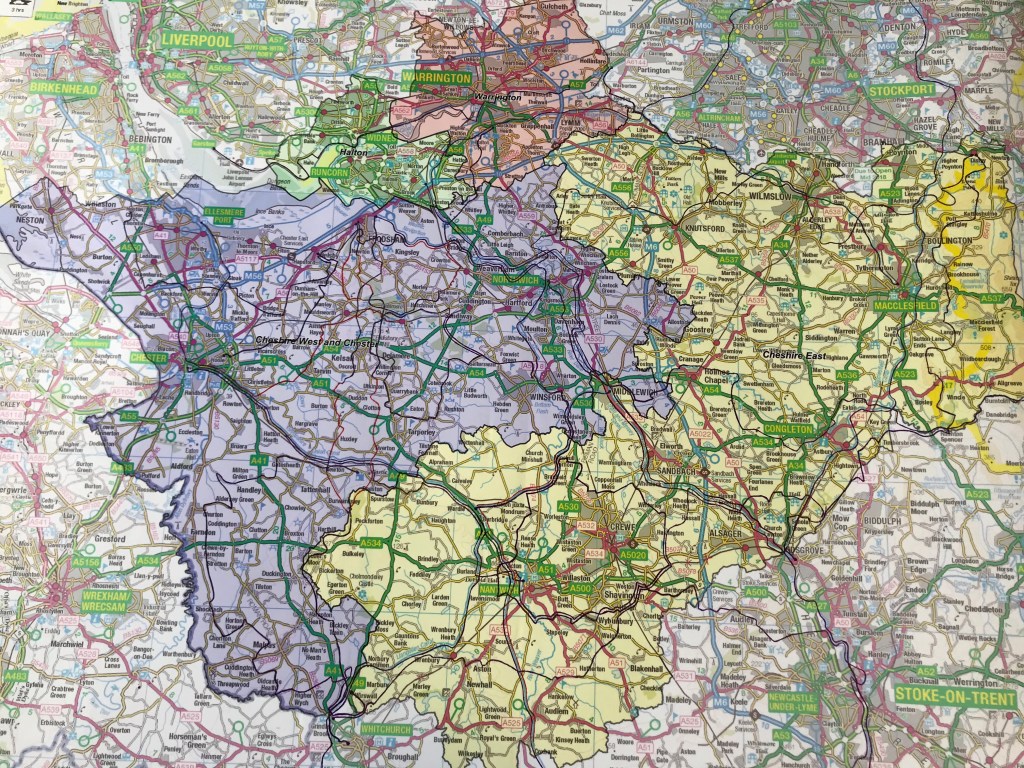
1:80,000 scale big. This scale is detailed enough to show B roads and villages, but big enough that the whole challenge fits on one piece of paper. It’s an Ordnance Survey map which meant tracing the paths from the LDWA website was fairly easy as I could zoom out to the same scale and transcribe what was on screen to the map. The intention was not to show every twist and turn of the paths, rather the overview of the places they passed through and how they related to each other. Where paths shared the same track on the ground I drew them as parallel lines, totally unrealistic as that would make them 300 meters apart but it meant I could see instantly how many paths shared that track. It took the best part of 10 hours and nearly 200 metres of pen ink but was very satisfying to see all 22 paths and how they interlinked or not in some cases!
Connecting the paths into routes for walks will be tricky. Some, like the Llangollen Canal, have no adjacent path in the challenge so I’ll probably turn them into multi-day walks and camp overnight. The trickier route planning to solve are the areas where there are many adjacent and crossing paths. The perfect solution is to find a series of circular walks that do not duplicate, don’t miss sections of path and minimise the number of paths not in the challenge. This is stepping into the world of computer science and the dark realms of P vs NP problems, way beyond what my brain can fathom so I’ll resign myself to a few odd walks to officially complete the challenge. If you have 45 minutes and want to boggle your mind, this In Our Time Podcast has a go at explaining it.
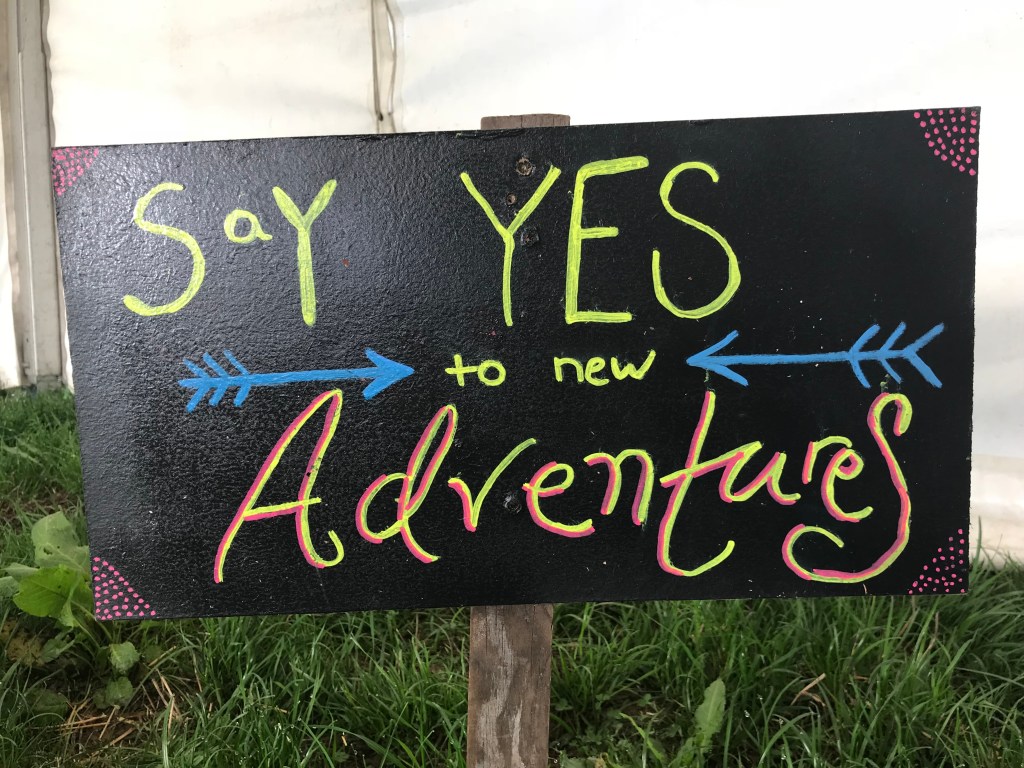
The master map!
After eating my celebratory Tunnock’s something was niggling at me. That purple shaded area over Hooton and Parkgate. So the following weekend I checked the website again. And the niggle was right.
Two of the rules I set myself were that the path must start or finish in Cheshire, and the path much be on the LDWA website. Following these rules and now with the big map i n front of me it was clear I had missed three paths and 108km. Out came the pens and the map was updated. This sets the challenge at 25 paths and just a fraction over 1500km, which are much nicer round numbers, don’t you think?
And to show the size of the task, I made a timelapse video of my efforts fuelled by gin, tea and Tunnocks! Enjoy!
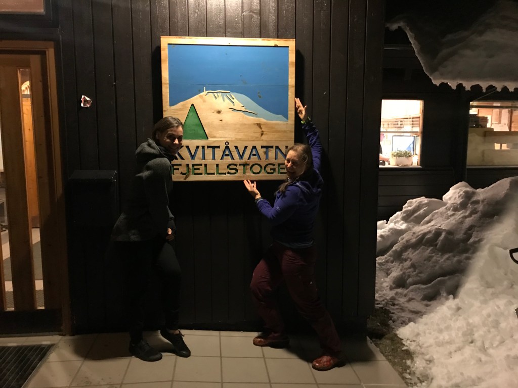
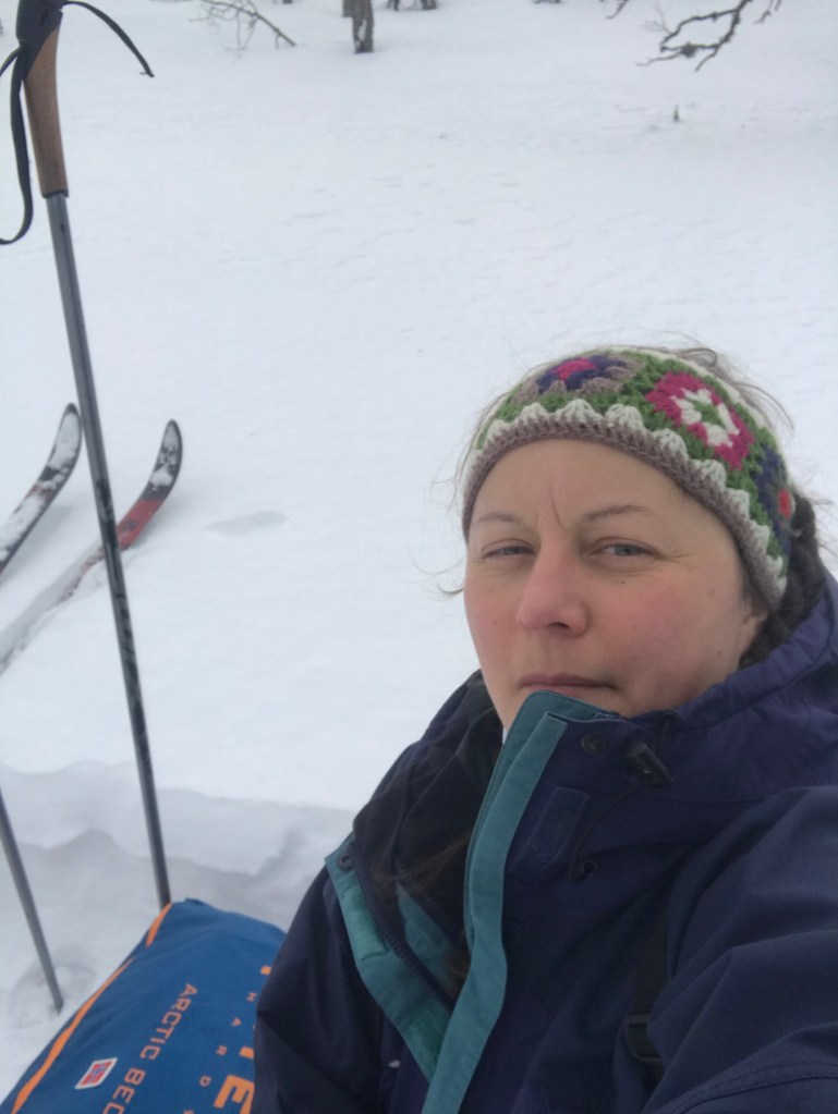
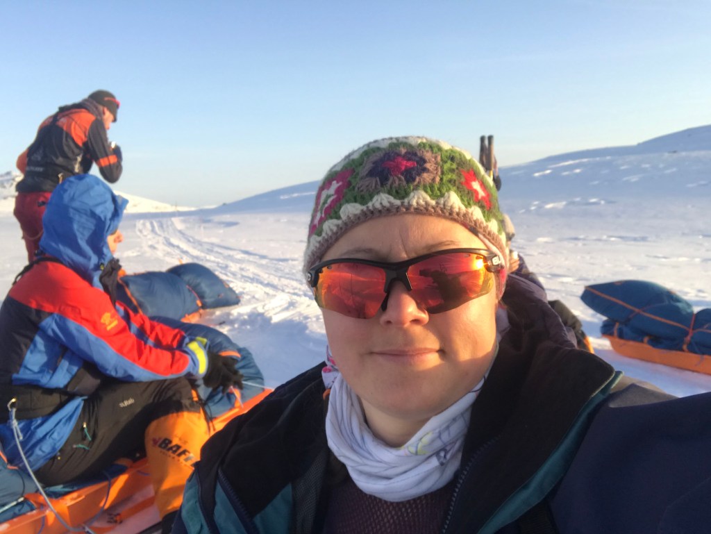
It’s a small world, or more likely the Tough Girl Tribe is big! Waiting at Oslo airport for transfer to Kvitåvatn, I caught the eye of another woman and we clocked we were waiting for the same bus. Turns out we are also fellow tribees and spent a lovely hour chatting over coffee. All troops gathered the bus set off and, after a brief stop to collect Helen plus all our kit for the week, we wound our way up to our base at Kvitåvatn Fjellstoge for the week. Kit unpacked, stories were swapped over dinner and we settled into our dorms.
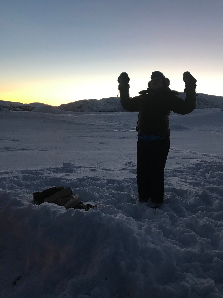
Very excited to have arrived!
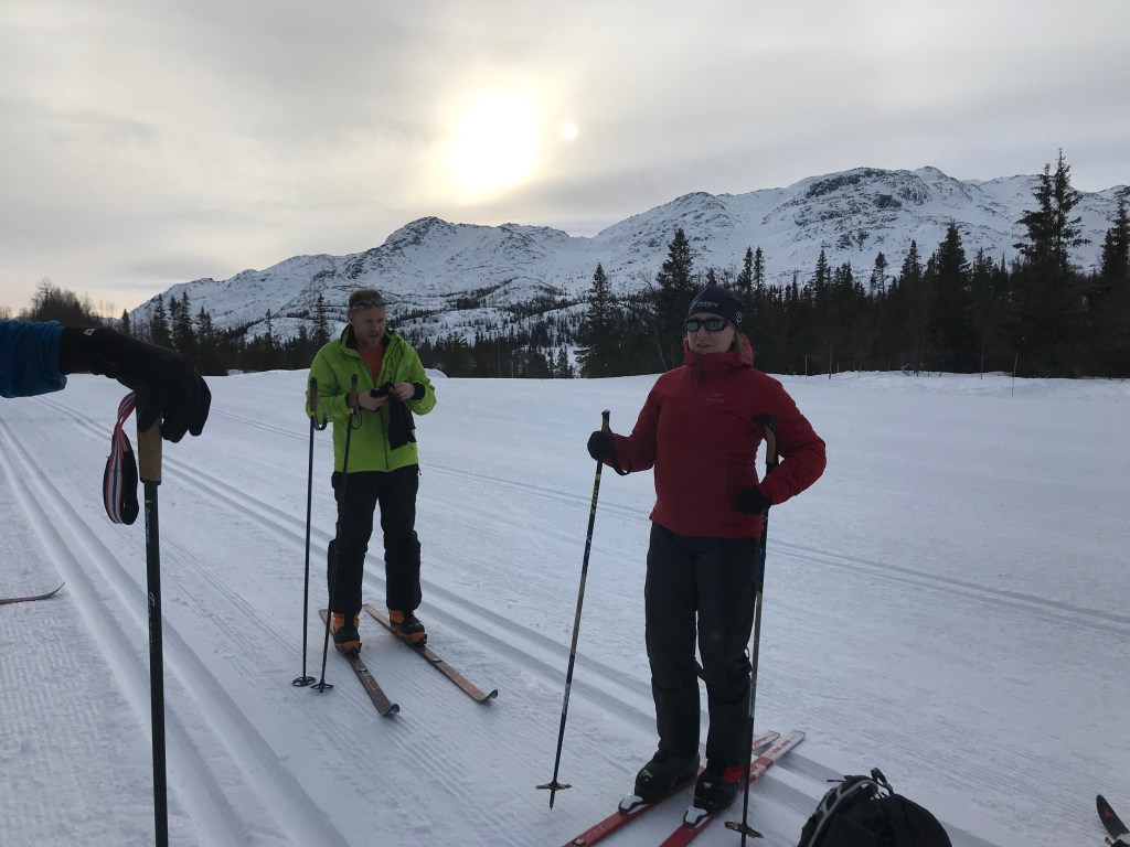
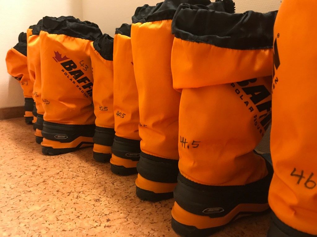
A hearty breakfast started the day well and we gathered for a briefing over tea. The basics covered, we headed over to collect skis and boots for our first lesson. We are all at different levels and I think I was the one with the least experience in snow, which in some ways had its advantage as I had no preconceptions. The morning was spent on the tracks around the lodge and weaving through the lovely wooden huts, ending with downhill and surprisingly few falls. Lunch and coffee set us up for an afternoon heading away from the lodge and across the frozen lake. My promising start faltered as I struggled to control my skis; a combination of poor skill and realising my feet didn’t fit the boots well. My feet moved far too much inside the thick, polar boot resulting in my skis not always following what my feet attempted to make them do, resulting in a few hissy fits. A post-lesson chat and a plan B for boots was formed and I took some time with Helen to review my kit for Svalbard.
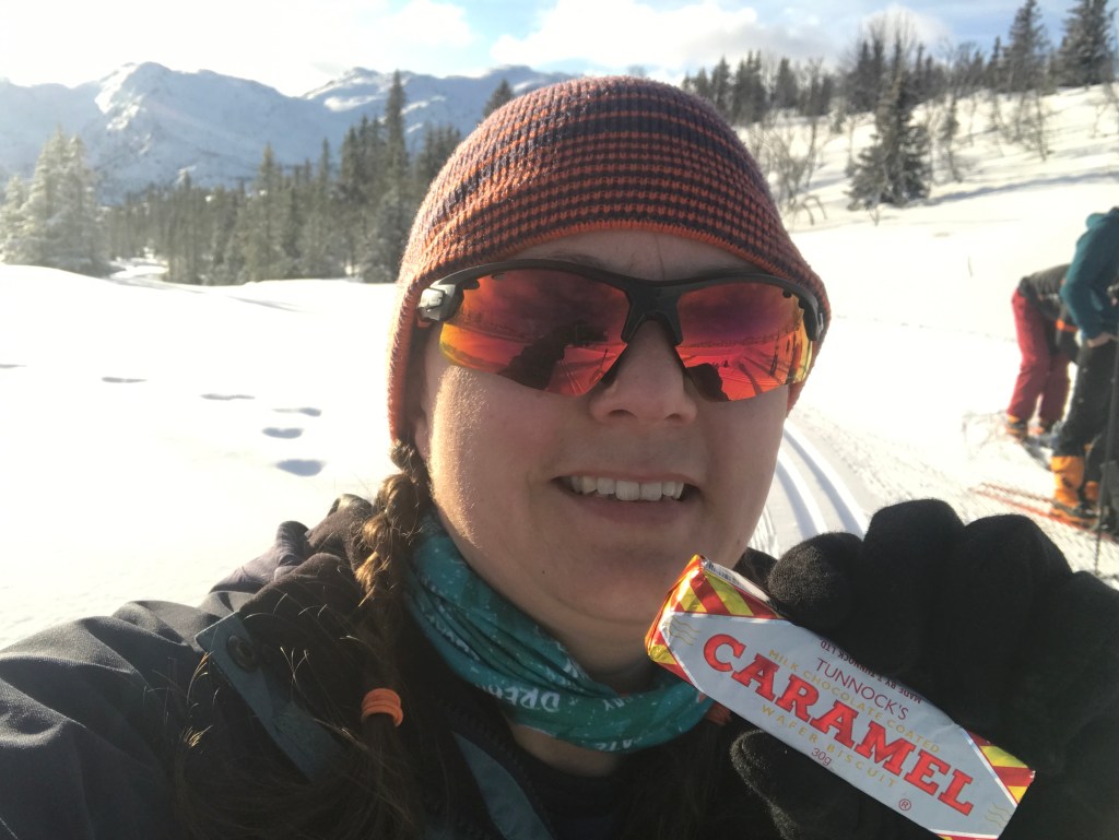
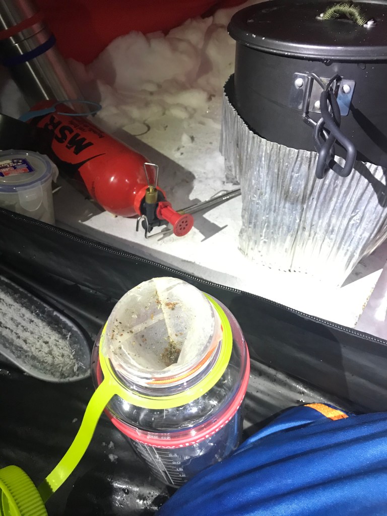
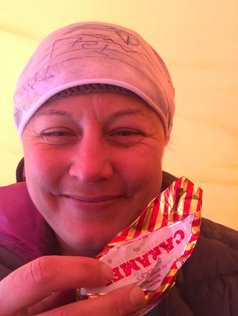
Day two started with another big breakfast and making up a plate for lunch. I swapped boots from the big Baffin ones to an old but more adjustable, smaller pair of Alfa boots and we set off to explore Skipsfjell, a neat 1,100 metre peak overlooking the ski centre. We tried different uphill techniques, traversing the deep snow to the summit then finding our own routes down through the deep snow. I felt much more in control and hugely enjoyed the glorious sun and sparkling snow; fuelled by a celebratory Tunnocks my confidence grew. The afternoon brought the next new skill, meeting the pulks which added a whole extra dimension which resulted in lots of new ways to fall over. Back at the lodge, it was kit sorting time. First up was getting to grips with the stove, an MSR expedition, taking it in turns to pressurise the fuel and light the burner and learning, importantly, how not to set the tent on fire. Next up was pulk packing. Like all good systems, there is both a science and an art to packing a pulk, ensuring quick access to things like snacks, water and warm gear, and dividing shared kit so weight is distributed fairly but also so if you get separated, you have tools to keep you warm. Packed and ready, we had another good dinner in the lodge and attention was turned to the worsening weather forecast.
As anticipated, high winds resulted in a change of plan. Hardandgervidda is a mountain plateau with little shelter, battling the wind to pitch tents for the first time would not have been the best introduction; the bus was cancelled and we had another cup of tea. Instead, we stayed closer to the lodge and more sheltered peaks. We climbed steadily up the cut tracks, weaving through the trees and a slightly nerve-wracking traverse of the pistes with laden pulks. We stopped early to get camp set up in daylight, finding a spot tucked behind a wood close to Longetjønn, a lake at about 1000m altitude. We dug out a base, pitched the tent and stated the stove to melt snow. Being under the trees, the snow was full of needles and lichen giving the water a very foresty taste. Although I’m sure fancy cafes would have paid a fortune for it, with the cunning application of a hairband and an emptied tea bag, a filter was fashioned and the water was no longer full of tree.
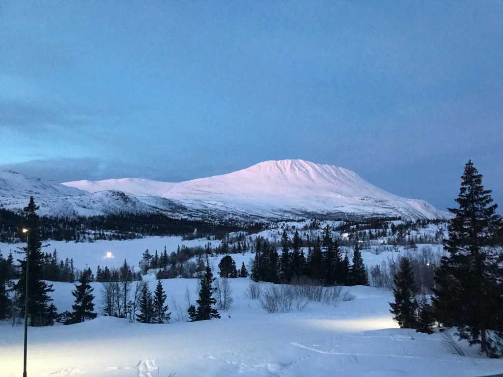
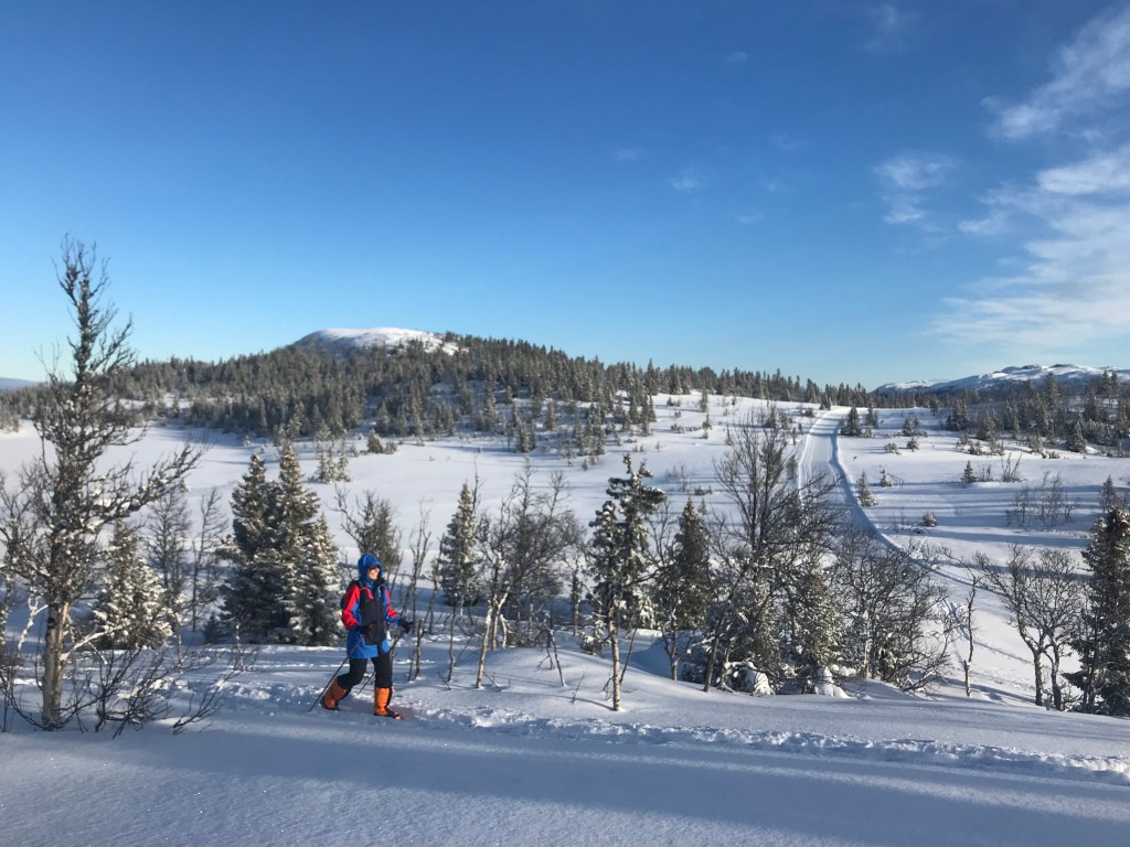
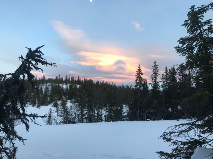
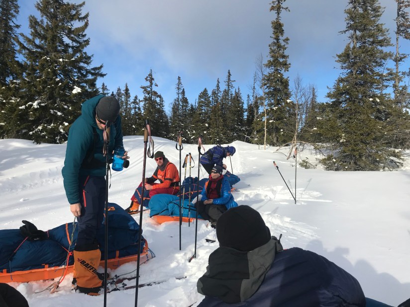
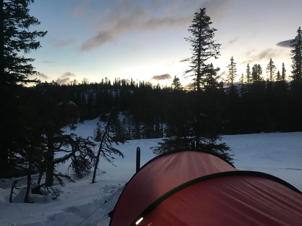
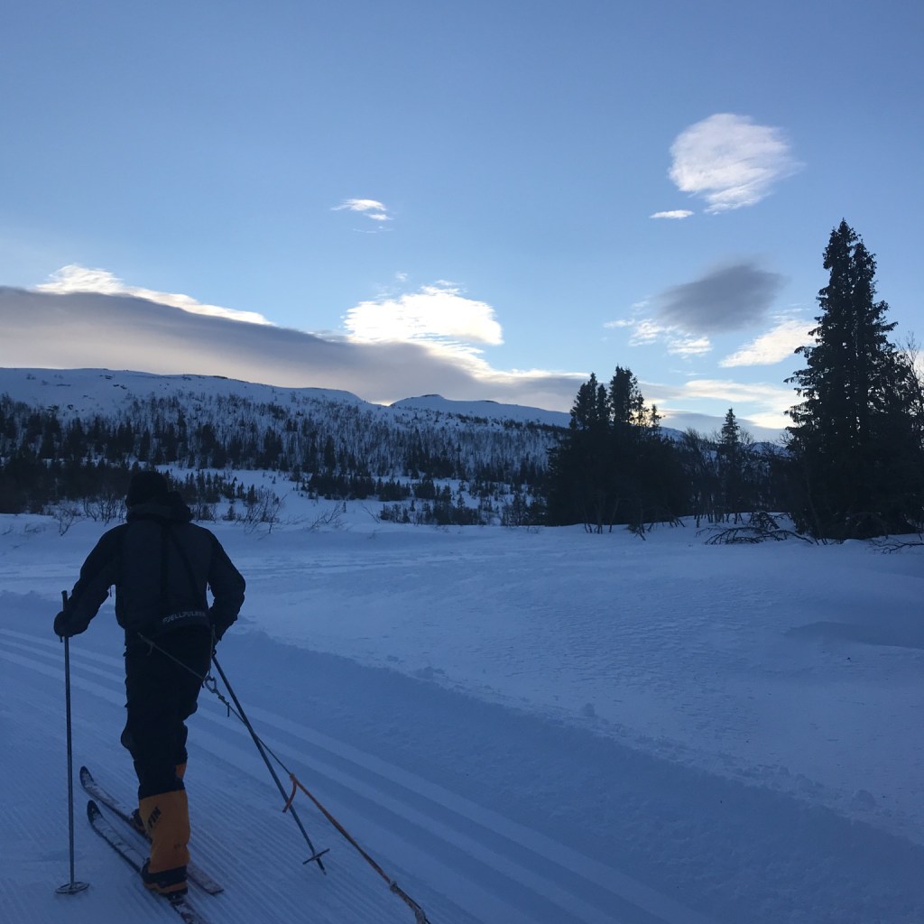
The wind was high during the night but it was a comforting sound, snug in my sleeping bag. After the best night’s sleep in a long time, the alarm went off and the process of melting water began. It took 2 ½ hours from alarm to ready to go: a lot of room for improvement in our camp craft. With the weather clearing we set off for the bus following the freshly cut tracks, my downhill had not improved over night resulting in a walk down the final stretch to the ski centre. A hot bus ride followed by a cable car found us at the foot of a winding track up to the plateau. The track was rutted from snow mobiles so rather than slog up on skis we packed them onto the pulks and walked. As the track opened up we put our skis back on and with the beautiful ridge of Gaustatoppen across the valley we skied on uncut tracks searching for a camp for the night. The perfect spot was found and, with tents pitched we set about building snow walls against the wind to protect our tents. Stoves burning to melt snow, the temperature dropped and the sky turned pink behind Gaustatoppen providing a breath-taking view while eating dinner. I was getting slicker at organising myself in the tent, the faff factor reducing. Socks drying and celebratory Tunnocks consumed another good night’s sleep was had.
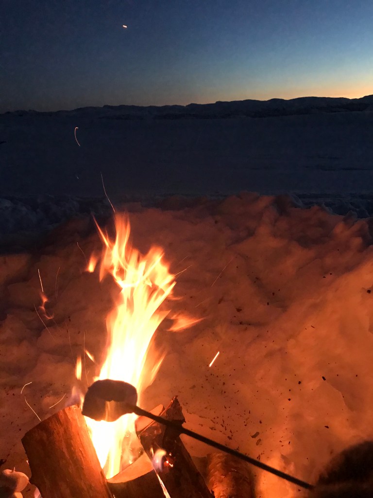
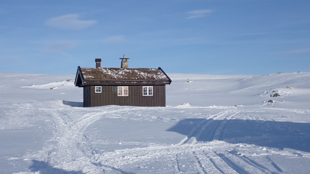
Morning brought a cloudless sunrise behind Gaustatoppen and a reduction in the morning faff by 30 minutes. Breakfast consumed with the addition of left over dark chocolate from yesterday’s rations, we slathered on the factor 50 in anticipation of a glorious day. We weren’t disappointed. We followed a marked trail under blue skies stopping every hour for snacks and water. Our target was a hytt (cabin) some 7km away, the furthest I’d skied in one go. The track wound through the hills, a few good pulls uphill to get the heart racing, and a few downhill with the inevitable fall for me. Arriving at Helberghytt, named after one of the Heroes of Telemark, we stopped for lunch. Sitting on our pulks eating cereal bars and trail mix basking in the sun it was possibly one of the most glorious places I had ever been and a truly perfect moment. Rested, we snuck into the cabin to have a nose; the stove was warm and the debris of evening drinks and a hearty breakfast were on the table. As we left the sound of snowmobiles disturbed the silence two obviously military blokes turned up: clearly relieved to hear that we weren’t planning on staying they waved us off as we set off for the afternoon. We took turns to lead the next leg, cutting tracks through the snow. This time our route took us across a lake where we took some time to practice climbing up and down the shoreline through deep snow with the sun warm on our faces. Camp was chosen in the lee of a small hill, this time we swapped tent buddies and I was one of three in a tent which meant a quick rework of the logistics for getting set up and the stove lit. This was our last night of camp so we set to digging a bench and fire pit, once done we made our dinners and settled around the crackling fire as the sun set behind mountains. We shared popcorn, toasted marshmallows and swapped stories, the highlight being Helen’s talk, with actions, on polar bears.
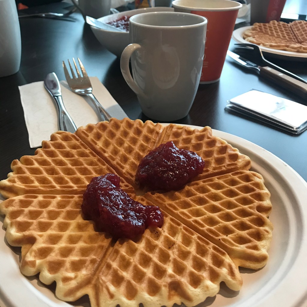
Overnight, the weather changed. We broke camp as a joint effort in heavy cloud and a rising wind, layering up before we set off for the last time. The snow made visibility poor so Helen lead the trickier navigation back to the track down to the cable car station. For the first time the weather was harsh enough to try my goggles, bought for Scottish winters but never used, the cheery orange contrasting the flat whiteness. We were all tiring and the contrast from yesterday’s sun set a grittier mood to the day, though the promise of waffles and coffee at the café set a determined pace. We picked up the track, which was still heavily rutted from snowmobiles. Multiple failed attempts to descend and I gave up, resorting to walking. My mood at this point sunk very low, I was worried I was not capable of this, if I can’t get down this without spending most of the time on my bum how could I possibly cross Svalbard? The demon of doubt took over and I plodded down the hill where Helen was waiting. With the others inside the café, I had a heart-to-heart with her. The moment she offered the possibility of doing a different expedition, I knew just how much I wanted to make the Svalbard crossing. So, planning to go back out and practice back at the lodge later that day once rested, we headed in. The warmth of the café enveloped us, the coffee was hot and the waffles smothered in jam: my demon of doubt was left out in the cold.
Back at the lodge and partially unpacked, I dug out my food rations from the four days. There was more left than I thought; it was instantly obvious to me one of the reasons my mood dipped so much. I stuffed my face with a cereal bar, chocolate and nuts, drank a mug of tea and got ready to head out. I had been contemplating on the bus back to the lodge how to deal with my continuing boot problem, the liners of the smaller boots were tight so I’d ended up wearing lighter socks which was OK for the conditions we had been in but no where near good enough for Svalbard. Using socks to create ankle cuffs, I adapted the larger Baffin boots to stop my heels from moving and got a pulk. A few times up and down the slope behind the lodge without a single tumble, I loaded the pulk with logs from the woodshed. I skied to the top of the slope, took a deep breath and… skied down with the pulk neatly at my side. Two more repeats to be sure it wasn’t a fluke and I decided to stop while I was ahead, taking mental notes of the subtle differences but also absorbing the clear fact that the real issue was in my head: as soon as I took the pressure off it all came together. I was ready for Svalbard.
If you want to learn all you need to participate in a polar expedition, this course was with Newland. Helen is a brilliant leader and hugely knowledgeable in all things polar, I can’t recommend them enough!
Going to Svalbard is going to be a huge learning curve for me, but the biggest challenge is skiing. The cold, the camping, the days on my feet covering long distances are all extensions of things I have done before: I have a vague idea of what I am letting myself in for and know I coped.
But skiing is a completely new skill.
I couldn’t afford to just go to somewhere snowy abroad (I didn’t have the holiday allocation anyway) and Scottish snow is not something to rely upon, especially as it would almost certainly be perfect conditions on the weekend I couldn’t go! So I needed to find another way to learn.
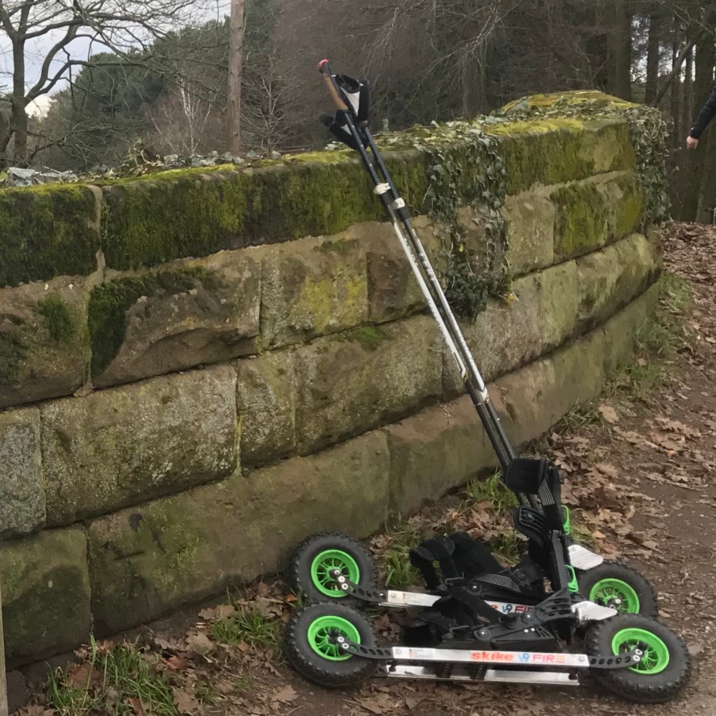
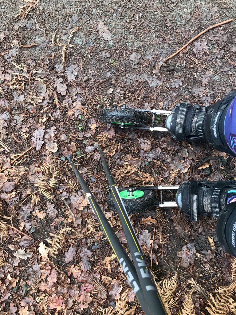
My Skikes
Back at Yestival 2018, when I announced I was going to Svalbard and that I couldn’t ski, someone suggested roller skis. I filed it in the back of my mind until, while on a course in London, I saw someone roller skiing in Greenwich Park. Some research later and I discovered Skikes. These are a little different – sort of what would happen if rollerblades and a mountain bike had a baby. They are German and looked very bad-ass: my shiny toy sensor pinged and I contacted, John at Skike Sports North.
John was very keen to help and I became the proud owner of a pair of V9 Fire Skikes. It’s always worth joining the Facebook groups for obscure sports or interests, they are often full of keen people with a passion that want to share it, I was soon directed to instruction videos, hints and tips and offers of help and encouragement.
Skikes on my feet
It was on a week’s holiday that I really started to get the hang of them.
Outside the cottage was over a mile of barely used rough tarmac leading to a forest track. I spent hours up and down, up and down while my calves screamed at me to stop. The next challenge was to Skike round the forest at home. This added the excitement of people and bikes and kids on bike darting around like over-excited squirrels, dogs and dogs on leads that stretched across the path in front of me.
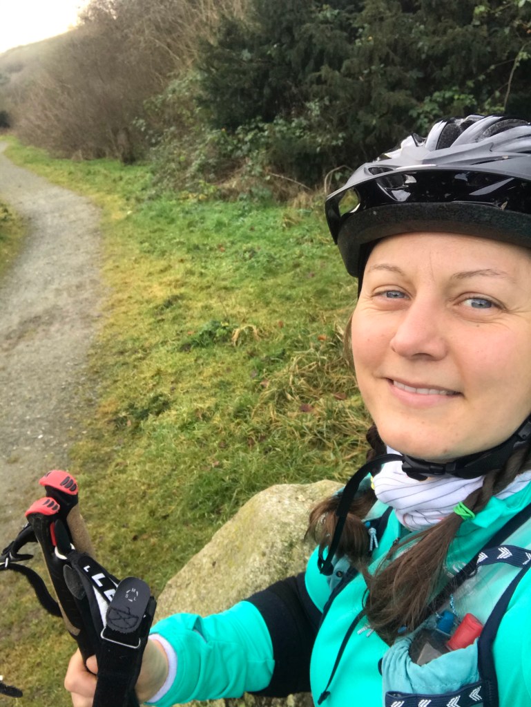
I nearly bottled it. I reached the gate and a huge dose of imposter syndrome hit. Who on earth am I, a 42 year old woman wearing novelty rollerblades and elbow pads? What if I fall over in front of someone? What if I rolled, out of control, taking out small children as I catered towards the lake? I had a moment. I did have a bit of a cry. And then I remembered Zoe Langley-Wathen’s 100 Scary Days, a challenge to get out of your comfort zone. I hoiked up my brave pants and set off. And guess what? It was fine. I didn’t fall over and didn’t visit the ducks in the lake. No one paid attention to me but my feet got lots of admiring glances with exclamations of “they’re cool!”. So, on to the next stage. Snow.
Feeling smug having not fallen over in front of the crowds
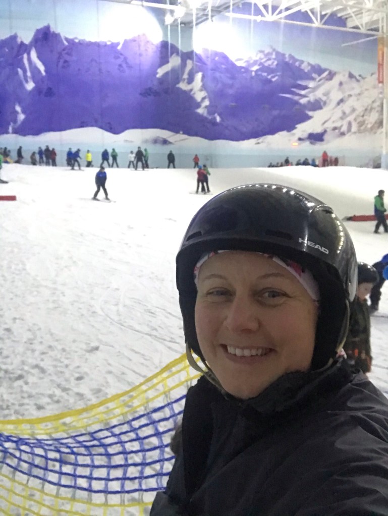
Imposter syndrome again. Sat in my hired ski boots and salopettes, surrounded by cool looking people in funky ski wear while I sweated uncomfortably in my outdoor gear. I was fearful of finding out I was really crap at skiing. I had made one good decision to have a full 6 hour lesson at Chill Factore in Manchester, rather than broken in to 3 lessons. Other groups were spending the first half an hour recapping what they did the last time, whereas we just kept going. And I discovered I loved it. And I wasn’t too bad at it either. Our instructor Paul B was brilliant, he adapted the lesson so all eight on the course got individual attention and got the most from it. By the end I was happily parallel turning and a bit sad I had to go home.
Getting the hang of this skiing malarkey
Done. Next stop, Polar Training in Kvitåvatn. Eek.
It started, as I think many adventures do, in the queue for mulled cider at Yestival.
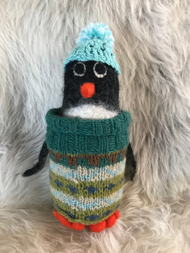
I finished cycling the Camino in October 2017 (blog here) and was feeling a combination of the post-adventure blues and a lack of direction. My husband had given me a felt penguin as a present from a business trip – The Penguin of Future Adventures. I named her Isabella Bird. Isabella Bird was an explorer and the first woman elected Fellow of the Royal Geographical Society, so it seemed a good name for an adventurous penguin.
I had taken Isabella Bird to Yestival, stuffed in the side pocket of my back pack. It was while queueing for the bar I met a friend i had made the previous year. We chatted about our adventures and he asked me what I planned to do next. I said I wasn’t sure: there were so many things I could do, another cycle tour, walk a trail, climb a mountain and that I was a little overwhelmed by the options. After listening to me a while, he said “well it has to be a cold adventure or the penguin can’t go”. And suddenly I had a direction: a cold adventure.
Cold is pretty much covered by places far north, far south or up high. Far south seemed expensive and too big a challenge to dare to do. Which left the arctic or a mountain. A smaller pool of possibility, but still pretty big. A opportunity arose in the form of the Fjallraven Polar, a dog sled expedition in the arctic. Even though I had no expectation of getting enough votes to participate, I was surprised just how many people voted for me. I liked the idea of a journey, maybe a traverse; and though I like the idea of a dog sled, the idea of a human-powered journey appealed. Years of stress at work had made me unfit, I was not comfortable in my body. I didn’t dislike my body, rather I had neglected it as was beginning to pay the price. A human-powered journey gave me a reason to train.
The final refinements of the plan came from talking to three amazing women: Sarah Williams, Adelaide Goodeve and Helen Turton. Sarah invited me on a Facebook live chat in the Tough Girl Tribe to talk about my adventure ideas and get some support from the tribe. This sparked the memory of Adelaide’s Svalbard adventure, after a good chat about it and allaying some of my fears she put me in contact with Helen and her company, Newland. A call to Helen and the plan was fixed. Svalbard!
Back at Yestival in October 2018, I stood on stage and told everyone my plan. No turning back.
Yestival 2018 – putting my brave-pants on to speak on the stage
The three Mountain Training Association qualification that are direct entry so don’t require a preceding qualification are Lowland (LL), Hill & Moorland (HML) and Mountain Leader (ML). Mountain Leader is the most popular, possibly because its better known and some organisations default request a mountain leader for leading groups regardless of the terrain. Although ML does cover all the bases, I would argue that the navigation for HML is often tougher – mountains are notable for having lots of distinguishable features unlike moorland! ML is also the most expensive of the three qualifications and the training and assessment is longer (two 5 day sessions, HML is two 3 day sessions), so I’d really recommend thinking about which is right for you and what you want to do with the qualification before signing up.
For all the qualifications you have to log 40 days in the relevant terrain, I live within easy driving of several areas of hill and moorland terrain so I could quickly decide to get out and log another day or bail if the weather was horrendous knowing I’d just go the next weekend. If I lived in the South East of England or Scotland I might have made a different decision on which qualification I picked! The Mountain Training Association (MTA) has a good guide to the courses here: https://www.mountain-training.org/help/articles/which-scheme-is-right-for-me
I took my assessment in February 2019: when I started the process is less clearly defined. I first learned that the HML qualification existed at the Women’s Climbing Symposium in October 2015, although I probably had walked the required 20 quality hill days (QHD) needed for the training, my records were vague so I only backdated about 5 walks. In hindsight, I was probably being over cautious and a bit of a perfectionist! My training was in January 2017 and though I planned to take the assessment in early 2018, I went through a rough time at work so decided to be kind to myself and delay it until 2019. Although technically possible to complete the whole course in 50 days, that’s not going to give you a good quality DLOG and a good DLOG is important.
So what’s a DLOG? This the MTA log for your walks. The best advice I was given during the training is to have a varied and detailed log, the log gives the assessor a view on the breadth of your experience. I recorded everything: lowland walks, climbing, winter mountain days and HML days that didn’t quite meet the criteria or were duplicates: showing that you are not just doing walks to gain the qualification but are an all-round outdoors enthusiast is seen as a positive. Of all the qualifications, HML terrain is the trickiest to define, there are mountains that fit HML criteria and moorland that can be classified as mountain terrain. The MTA defines it as:
Open, uncultivated, non-mountainous high or remote country known variously as upland, moor, bog, fell, hill or down.
Areas enclosed by well-defined geographical or man-made boundaries such as roads (areas that border mountain regions and do not have well defined boundaries are excluded)
Areas of remoteness that are exited by the group in a few hours, returning to a refuge or an accessible road
Areas where movement on steep or rocky terrain is not required (in either a planned or unplanned situation)
The areas that I walked were: White and Dark Peak District, North York Moors, Yorkshire Dales, Clwyds, Denbigh Moor, Long Mynd, Northumberland National Park, Southern Uplands.
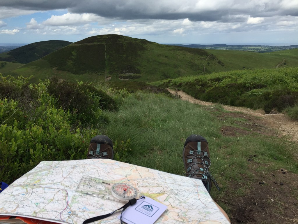
Checking the navigation on Offa’s Dyke, Clwyds
You have to log walks in at least three different upland areas and in all seasons. The easiest way to record the route is to use a GPS tracker, which is what I did. I then used the description space on the log to record wildlife I had seen, explanations for a decision made such as why I cut the walk short or kit I chose to take, who I was walking with and any points of interest. I also added photos relevant to the comments I made in the description space. At the assessment, I was complimented on the quality of my DLOG: a good log isn’t enough on its own to pass but it definitely helps.
The book that became my bible for this was Hillwalking, the official handbook from the MTA. EVERYTHING you need to know is in here! It covers LL, HML and ML so some of the sections are not relevant but still interesting to know. The other book that I read was Nature of Snowdonia: A Beginner’s Guide to the Upland Environment – this is relevant for all upland areas and collates it all by seasons which meant I only swatted up on the relevant season for my assessment. It’s a bit hard to get hold of but worth it. Additionally I would do a bit of research on the area I had planned a walk, any history or geology that would be interesting to a party of walkers.
Waiting in the dark after night navigation
The training is exactly that: it covers everything you need to know for the assessment. But again preparation helps you get the most from it! I started putting together a list of questions I had on the syllabus as I completed the last few walks for my DLOG and made sure I had answers to all of them before the end of the course. I was given feedback on the areas I needed to focus on: the 20 walks after the training are the consolidation and the time to practice this before the assessment. Training focuses heavily on navigation, including night navigation and micro navigation. I purposely booked a course in January for the long night, night nav will take at least 2-3 hours (longer if the other groups get lost…) and the following day starts at 9am sharp so the earlier you can start the longer you get in bed! Take plenty of food and drink on night nav day, we stayed out from the day’s walk and though I did have enough with me it was more luck that judgement, my group had to wait as the other group got lost. Having a cereal bar and a bit of hot Vimto left made it a more pleasant experience! There is also classroom based work on topics like the weather, we were asked to do some homework so having my laptop back at my accommodation was handy.
The walks logged between training and assessment are the consolidation period and the time to practice the new skills gained on the training and to polish old ones. Although it felt a bit silly doing it with friends, I acted as if they were a group of strangers at the start of the walk: doing a kit check, showing them the route, asking if they had any questions. I practised micro navigation, looking for ring contours or reentrants on the map and using my GPS to check I had found them. If you have a friend experienced in micro and night navigation do ask them to test you, this gave me a lot of confidence for the assessment that I wasn’t just setting myself easy challenges or being too hard on myself. I made sure I planned routes that meant I had to walk off path as much as possible and get used to walking on a bearing but also (and probably more importantly) from reading the ground, such as following contours. I also made sure I walked in bad weather – not to the point where it was unsafe – but to have trust my kit and be comfortable being uncomfortable.
Logging walks in all weathers is important
I also took advantage of the MTA mentoring program, at the time running as a trial but is now rolled out across the North West and South East with other areas to follow for MTA members. This was hugely beneficial to me, my mentor supported me on specific skills I wanted to focus on, ran through scenarios with me and generally be someone I could call on to as the occasional silly question. If the scheme is available I’d really encourage you to apply once you have completed the training.
The qualification requires you to hold a first aid qualification, preferably specifically for the outdoors and a minimum of 16 hours training time. I took mine about 9 months before the assessment so that it was still in date for the assessment.
If you are already a keen hill walker, you will have the right kit. There are no specific additional bits of kit, other than taking what you would need for a group. Carrying a spare hat, gloves and fleece is expected: for the assessment take spares from your own kit but for leading groups I have bought spares from https://www.decathlon.co.uk/ which are cheap and good quality just in case I forget to ask for it back at the end of a walk! You will need a good first aid kit and a group shelter. The group shelter was the only kit I had to buy specifically for the assessment but others on the assessment had borrowed theirs.
For the assessment, preparation is king. For the three days you need to act like a walk leader at all times and be ready to go on time, its not cheating to have your last few walks in the assessment area so you are familiar with it under pressure! I stayed at the assessment centre with self catering facilities and took meals that were quick and easy to make and didn’t require thinking. Some others went to the pub or went to look for somewhere to eat but for me that added an extra thing to do when I was tired and needed to eat, prepare for the following day and have a quiet evening. It felt a little anti-social but I was there to be assessed on something I had work hard for and a night on the beers could have scuppered everything! About 2-3 weeks before the assessment you will be set some pre-work to do, a question paper and to prepare a 5-10 minute talk on a preset subject: mine was on hypo- and hyperthermia, the other candidates gave a talk on wild life and on the access rights.
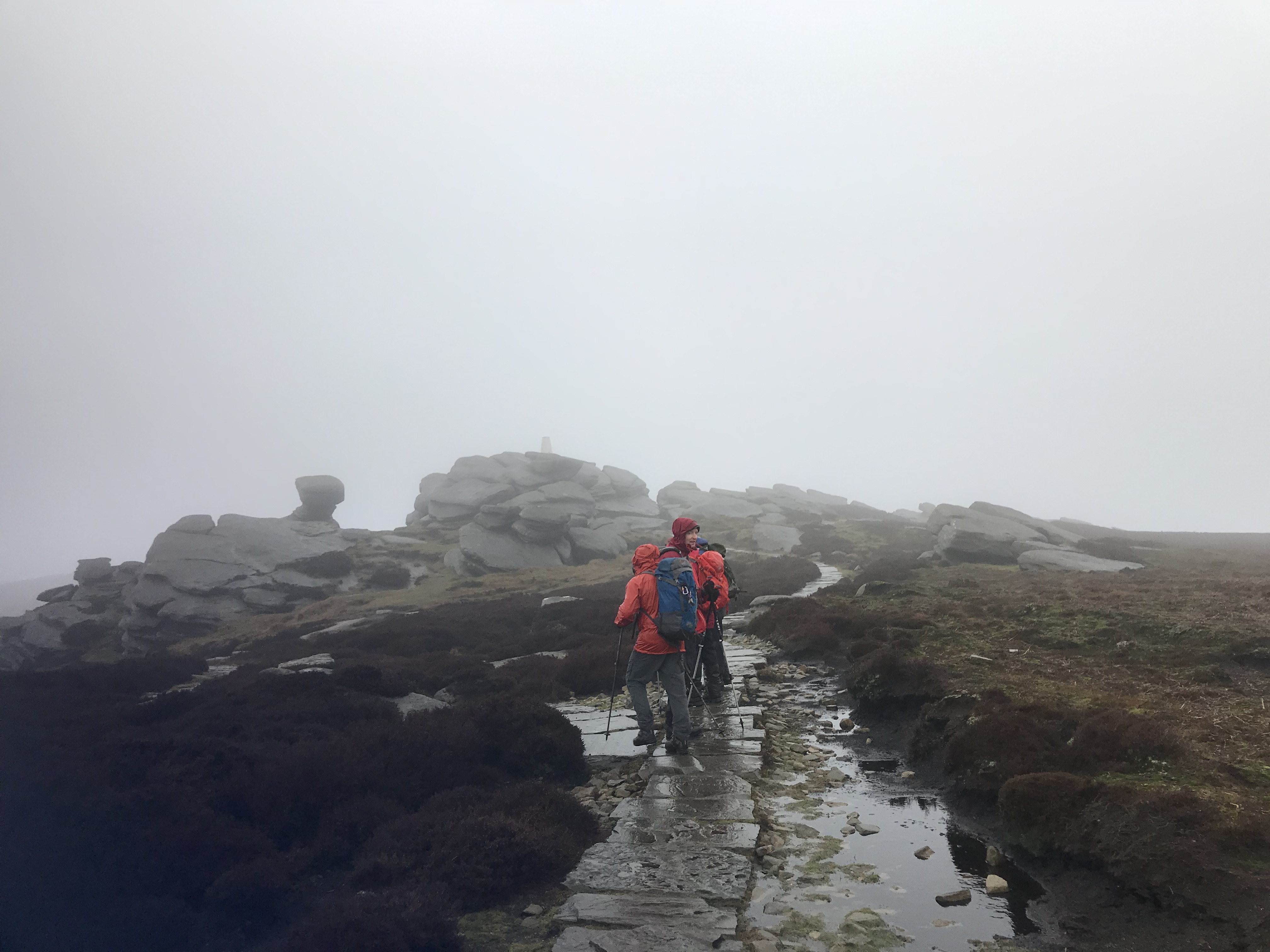
Snack stop on the Kinder Plateau
I keep my kit collated in dry bags so I could check my pack at a glance and know I had everything. After an initial bag check by the assessor where we talked about what we had and why, we rationalised the group kit among us to lighten out packs. MTA uses OS Explorer map and you are expected to have your own map with you for the assessment. Get the weatherproof one as the assessor will dot the map with a permanent marker for your navigation target. The extra few pounds for a map that won’t disintegrate in the rain or move inside a map pocket and misalign the target is worth the stress reduction!
The assessment was nearly all on the hills and focused on navigation. While one of the candidates was leading the navigation, the others had to follow and show the assessor where we were when the leader declared they were at the designated ‘dot’ on the map so you are concentrating the whole time. The biggest bit of advice I can give is tell your assessor what you navigation plan is and if you change your strategy, tell them! I was properly flustered on my first navigation leg but the assessment is three days and the assessors know that the stress levels are really high: there is plenty of time over the three days to make up for an early howler. You’re expected to act like a leader so while navigating do check the others are OK and still following you! The assessor also asked questions on flora and fauna, geology and the topics you need to have a basic understanding of, I was also asked to talk through how I would deal with an emergency scenario. The night navigation for HML is about getting off the hill safely at the end of a long day, the practice is the same as for day navigation with one taking the lead and the others following but keeping track on the map. On the last day, you’ll be told if you have passed, deferred or failed. Forgetting to bring you first aid certificate will get you a deferral: so don’t forget it! A deferral is when you have not quite met the standard required and you need to complete part of the assessment again, ideally back at the same assessment centre.
And that was it, I passed and was given some great feedback. It was a brilliant experience and a huge confidence boost, I’d really recommend gaining the qualification to anyone that likes to lead others out in the hills.
So how much did all this cost? Below are the outline costs of the course or specific things I paid for, I have not included my walking kit as I had most of this already and any costs incurred were from replacing worn out items or shiny things I couldn’t resist! I didn’t keep a record of the costs for the walks in my DLOG so they are also not included.