
The three Mountain Training Association qualification that are direct entry so don’t require a preceding qualification are Lowland (LL), Hill & Moorland (HML) and Mountain Leader (ML). Mountain Leader is the most popular, possibly because its better known and some organisations default request a mountain leader for leading groups regardless of the terrain. Although ML does cover all the bases, I would argue that the navigation for HML is often tougher – mountains are notable for having lots of distinguishable features unlike moorland! ML is also the most expensive of the three qualifications and the training and assessment is longer (two 5 day sessions, HML is two 3 day sessions), so I’d really recommend thinking about which is right for you and what you want to do with the qualification before signing up.
For all the qualifications you have to log 40 days in the relevant terrain, I live within easy driving of several areas of hill and moorland terrain so I could quickly decide to get out and log another day or bail if the weather was horrendous knowing I’d just go the next weekend. If I lived in the South East of England or Scotland I might have made a different decision on which qualification I picked! The Mountain Training Association (MTA) has a good guide to the courses here: https://www.mountain-training.org/help/articles/which-scheme-is-right-for-me
I took my assessment in February 2019: when I started the process is less clearly defined. I first learned that the HML qualification existed at the Women’s Climbing Symposium in October 2015, although I probably had walked the required 20 quality hill days (QHD) needed for the training, my records were vague so I only backdated about 5 walks. In hindsight, I was probably being over cautious and a bit of a perfectionist! My training was in January 2017 and though I planned to take the assessment in early 2018, I went through a rough time at work so decided to be kind to myself and delay it until 2019. Although technically possible to complete the whole course in 50 days, that’s not going to give you a good quality DLOG and a good DLOG is important.
So what’s a DLOG? This the MTA log for your walks. The best advice I was given during the training is to have a varied and detailed log, the log gives the assessor a view on the breadth of your experience. I recorded everything: lowland walks, climbing, winter mountain days and HML days that didn’t quite meet the criteria or were duplicates: showing that you are not just doing walks to gain the qualification but are an all-round outdoors enthusiast is seen as a positive. Of all the qualifications, HML terrain is the trickiest to define, there are mountains that fit HML criteria and moorland that can be classified as mountain terrain. The MTA defines it as:
- Open, uncultivated, non-mountainous high or remote country known variously as upland, moor, bog, fell, hill or down.
- Areas enclosed by well-defined geographical or man-made boundaries such as roads (areas that border mountain regions and do not have well defined boundaries are excluded)
- Areas of remoteness that are exited by the group in a few hours, returning to a refuge or an accessible road
- Areas where movement on steep or rocky terrain is not required (in either a planned or unplanned situation)
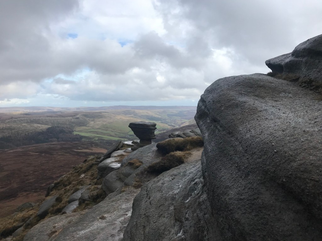
The areas that I walked were: White and Dark Peak District, North York Moors, Yorkshire Dales, Clwyds, Denbigh Moor, Long Mynd, Northumberland National Park, Southern Uplands.
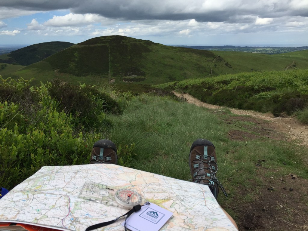
You have to log walks in at least three different upland areas and in all seasons. The easiest way to record the route is to use a GPS tracker, which is what I did. I then used the description space on the log to record wildlife I had seen, explanations for a decision made such as why I cut the walk short or kit I chose to take, who I was walking with and any points of interest. I also added photos relevant to the comments I made in the description space. At the assessment, I was complimented on the quality of my DLOG: a good log isn’t enough on its own to pass but it definitely helps.
The book that became my bible for this was Hillwalking, the official handbook from the MTA. EVERYTHING you need to know is in here! It covers LL, HML and ML so some of the sections are not relevant but still interesting to know. The other book that I read was Nature of Snowdonia: A Beginner’s Guide to the Upland Environment – this is relevant for all upland areas and collates it all by seasons which meant I only swatted up on the relevant season for my assessment. It’s a bit hard to get hold of but worth it. Additionally I would do a bit of research on the area I had planned a walk, any history or geology that would be interesting to a party of walkers.

The training is exactly that: it covers everything you need to know for the assessment. But again preparation helps you get the most from it! I started putting together a list of questions I had on the syllabus as I completed the last few walks for my DLOG and made sure I had answers to all of them before the end of the course. I was given feedback on the areas I needed to focus on: the 20 walks after the training are the consolidation and the time to practice this before the assessment. Training focuses heavily on navigation, including night navigation and micro navigation. I purposely booked a course in January for the long night, night nav will take at least 2-3 hours (longer if the other groups get lost…) and the following day starts at 9am sharp so the earlier you can start the longer you get in bed! Take plenty of food and drink on night nav day, we stayed out from the day’s walk and though I did have enough with me it was more luck that judgement, my group had to wait as the other group got lost. Having a cereal bar and a bit of hot Vimto left made it a more pleasant experience! There is also classroom based work on topics like the weather, we were asked to do some homework so having my laptop back at my accommodation was handy.
The walks logged between training and assessment are the consolidation period and the time to practice the new skills gained on the training and to polish old ones. Although it felt a bit silly doing it with friends, I acted as if they were a group of strangers at the start of the walk: doing a kit check, showing them the route, asking if they had any questions. I practised micro navigation, looking for ring contours or reentrants on the map and using my GPS to check I had found them. If you have a friend experienced in micro and night navigation do ask them to test you, this gave me a lot of confidence for the assessment that I wasn’t just setting myself easy challenges or being too hard on myself. I made sure I planned routes that meant I had to walk off path as much as possible and get used to walking on a bearing but also (and probably more importantly) from reading the ground, such as following contours. I also made sure I walked in bad weather – not to the point where it was unsafe – but to have trust my kit and be comfortable being uncomfortable.
I also took advantage of the MTA mentoring program, at the time running as a trial but is now rolled out across the North West and South East with other areas to follow for MTA members. This was hugely beneficial to me, my mentor supported me on specific skills I wanted to focus on, ran through scenarios with me and generally be someone I could call on to as the occasional silly question. If the scheme is available I’d really encourage you to apply once you have completed the training.
The qualification requires you to hold a first aid qualification, preferably specifically for the outdoors and a minimum of 16 hours training time. I took mine about 9 months before the assessment so that it was still in date for the assessment.
If you are already a keen hill walker, you will have the right kit. There are no specific additional bits of kit, other than taking what you would need for a group. Carrying a spare hat, gloves and fleece is expected: for the assessment take spares from your own kit but for leading groups I have bought spares from https://www.decathlon.co.uk/ which are cheap and good quality just in case I forget to ask for it back at the end of a walk! You will need a good first aid kit and a group shelter. The group shelter was the only kit I had to buy specifically for the assessment but others on the assessment had borrowed theirs.
For the assessment, preparation is king. For the three days you need to act like a walk leader at all times and be ready to go on time, its not cheating to have your last few walks in the assessment area so you are familiar with it under pressure! I stayed at the assessment centre with self catering facilities and took meals that were quick and easy to make and didn’t require thinking. Some others went to the pub or went to look for somewhere to eat but for me that added an extra thing to do when I was tired and needed to eat, prepare for the following day and have a quiet evening. It felt a little anti-social but I was there to be assessed on something I had work hard for and a night on the beers could have scuppered everything! About 2-3 weeks before the assessment you will be set some pre-work to do, a question paper and to prepare a 5-10 minute talk on a preset subject: mine was on hypo- and hyperthermia, the other candidates gave a talk on wild life and on the access rights.
I keep my kit collated in dry bags so I could check my pack at a glance and know I had everything. After an initial bag check by the assessor where we talked about what we had and why, we rationalised the group kit among us to lighten out packs. MTA uses OS Explorer map and you are expected to have your own map with you for the assessment. Get the weatherproof one as the assessor will dot the map with a permanent marker for your navigation target. The extra few pounds for a map that won’t disintegrate in the rain or move inside a map pocket and misalign the target is worth the stress reduction!
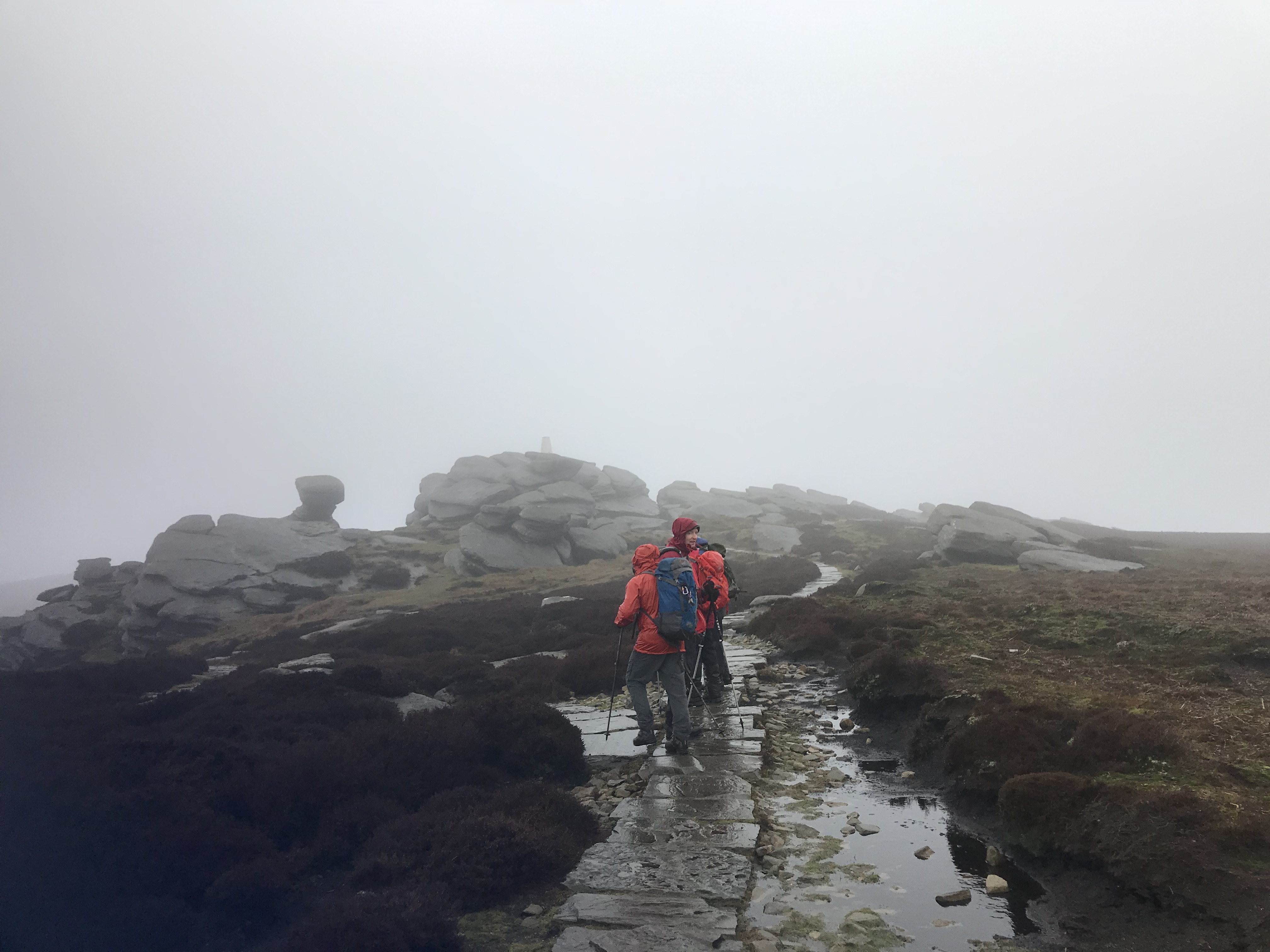
The assessment was nearly all on the hills and focused on navigation. While one of the candidates was leading the navigation, the others had to follow and show the assessor where we were when the leader declared they were at the designated ‘dot’ on the map so you are concentrating the whole time. The biggest bit of advice I can give is tell your assessor what you navigation plan is and if you change your strategy, tell them! I was properly flustered on my first navigation leg but the assessment is three days and the assessors know that the stress levels are really high: there is plenty of time over the three days to make up for an early howler. You’re expected to act like a leader so while navigating do check the others are OK and still following you! The assessor also asked questions on flora and fauna, geology and the topics you need to have a basic understanding of, I was also asked to talk through how I would deal with an emergency scenario. The night navigation for HML is about getting off the hill safely at the end of a long day, the practice is the same as for day navigation with one taking the lead and the others following but keeping track on the map. On the last day, you’ll be told if you have passed, deferred or failed. Forgetting to bring you first aid certificate will get you a deferral: so don’t forget it! A deferral is when you have not quite met the standard required and you need to complete part of the assessment again, ideally back at the same assessment centre.
And that was it, I passed and was given some great feedback. It was a brilliant experience and a huge confidence boost, I’d really recommend gaining the qualification to anyone that likes to lead others out in the hills.
So how much did all this cost? Below are the outline costs of the course or specific things I paid for, I have not included my walking kit as I had most of this already and any costs incurred were from replacing worn out items or shiny things I couldn’t resist! I didn’t keep a record of the costs for the walks in my DLOG so they are also not included.
| 3 years of MTA membership | £110 |
| 3 years DLOG subscription (£1.99 per month) | £75 |
| Hillwalking handbook | £17 |
| Nature of Snowdonia book | £15 |
| Non-residential training course | £210 |
| Training course accomodation | £15 |
| First Aid course | £120 |
| 8 person shelter | £59 |
| Waterproof OS map | £15 |
| Residential assement | £240 |
| TOTAL | £876 |
