Adventure planning, Cheshire Challenge, How I...

Mapping the Cheshire Challenge

Although I had completed about 80km of the challenge, it was clear that I needed to be a bit more strategic in planning walks or I’d end up repeating paths or, worse, leave lots of little missed sections. So time to think big!

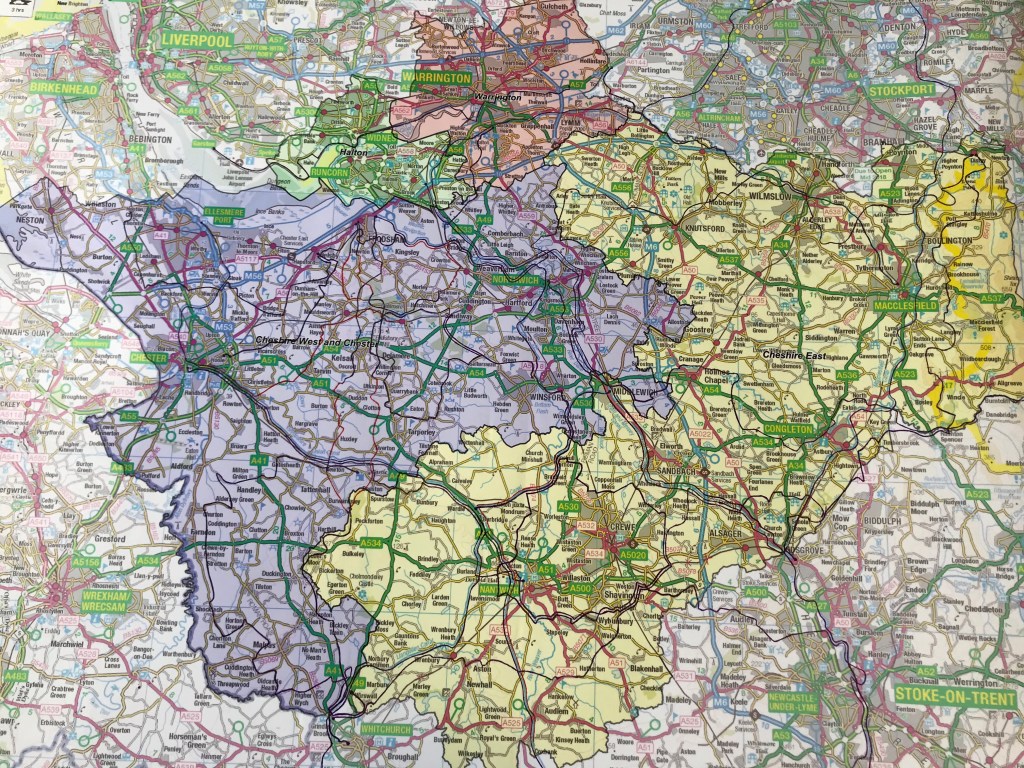
1:80,000 scale big. This scale is detailed enough to show B roads and villages, but big enough that the whole challenge fits on one piece of paper. It’s an Ordnance Survey map which meant tracing the paths from the LDWA website was fairly easy as I could zoom out to the same scale and transcribe what was on screen to the map. The intention was not to show every twist and turn of the paths, rather the overview of the places they passed through and how they related to each other. Where paths shared the same track on the ground I drew them as parallel lines, totally unrealistic as that would make them 300 meters apart but it meant I could see instantly how many paths shared that track. It took the best part of 10 hours and nearly 200 metres of pen ink but was very satisfying to see all 22 paths and how they interlinked or not in some cases!

Connecting the paths into routes for walks will be tricky. Some, like the Llangollen Canal, have no adjacent path in the challenge so I’ll probably turn them into multi-day walks and camp overnight. The trickier route planning to solve are the areas where there are many adjacent and crossing paths. The perfect solution is to find a series of circular walks that do not duplicate, don’t miss sections of path and minimise the number of paths not in the challenge. This is stepping into the world of computer science and the dark realms of P vs NP problems, way beyond what my brain can fathom so I’ll resign myself to a few odd walks to officially complete the challenge. If you have 45 minutes and want to boggle your mind, this In Our Time Podcast has a go at explaining it.

A large map of Cheshire with hand drawn paths
The master map!

After eating my celebratory Tunnock’s something was niggling at me. That purple shaded area over Hooton and Parkgate. So the following weekend I checked the website again. And the niggle was right.

Two of the rules I set myself were that the path must start or finish in Cheshire, and the path much be on the LDWA website. Following these rules and now with the big map i n front of me it was clear I had missed three paths and 108km. Out came the pens and the map was updated. This sets the challenge at 25 paths and just a fraction over 1500km, which are much nicer round numbers, don’t you think?

A pen and Tunnock Caramel wafer on a map

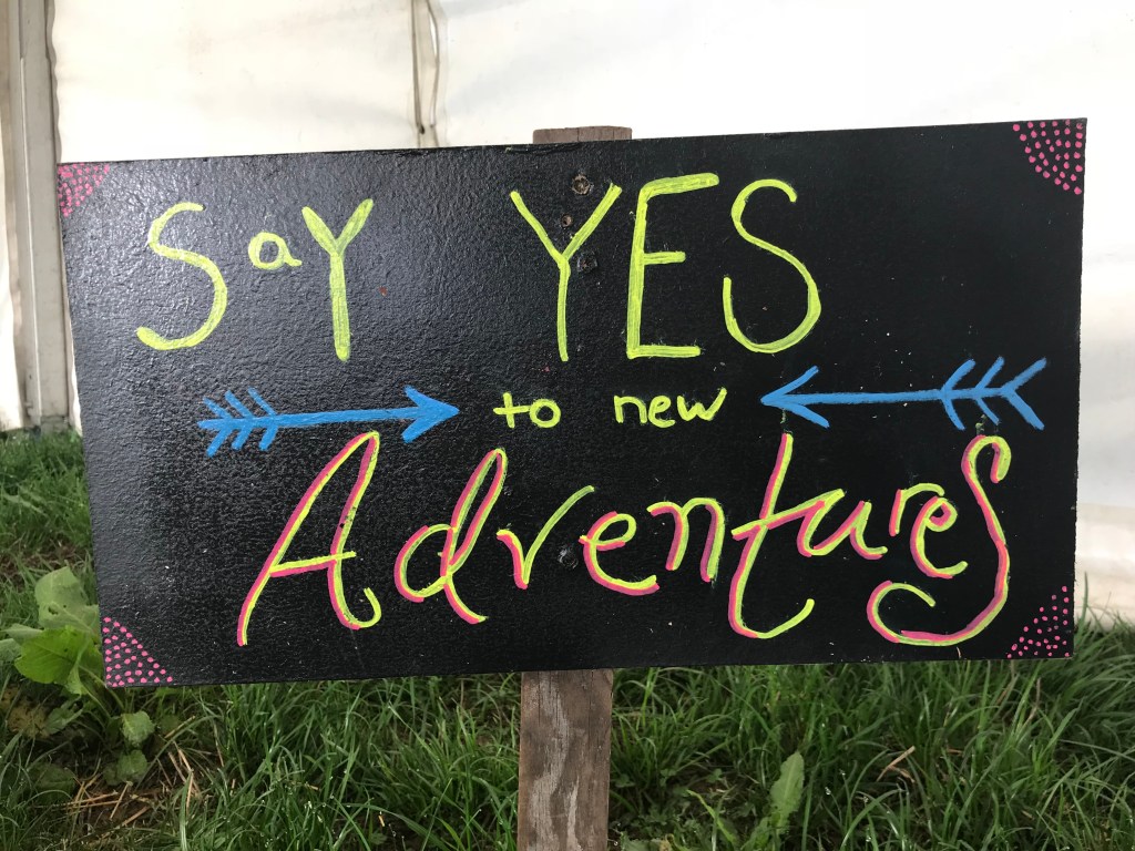
And to show the size of the task, I made a timelapse video of my efforts fuelled by gin, tea and Tunnocks! Enjoy!

Adventure planning, How I..., Journey to Svalbard

How I… Decided on a cold adventure

It started, as I think many adventures do, in the queue for mulled cider at Yestival.

A felt penguin wearing a fair isle jumper and bobble hat

I finished cycling the Camino in October 2017 (blog here) and was feeling a combination of the post-adventure blues and a lack of direction.  My husband had given me a felt penguin as a present from a business trip – The Penguin of Future Adventures.  I named her Isabella Bird. Isabella Bird was an explorer and the first woman elected Fellow of the Royal Geographical Society, so it seemed a good name for an adventurous penguin.

A chalk board sign "say YES to new Adventures"

I had taken Isabella Bird to Yestival, stuffed in the side pocket of my back pack.  It was while queueing for the bar I met a friend i had made the previous year.  We chatted about our adventures and he asked me what I planned to do next.  I said I wasn’t sure: there were so many things I could do, another cycle tour, walk a trail, climb a mountain and that I was a little overwhelmed by the options.  After listening to me a while, he said “well it has to be a cold adventure or the penguin can’t go”.  And suddenly I had a direction: a cold adventure.

Cold is pretty much covered by places far north, far south or up high.  Far south seemed expensive and too big a challenge to dare to do.  Which left the arctic or a mountain.  A smaller pool of possibility, but still pretty big.  A opportunity arose in the form of the Fjallraven Polar, a dog sled expedition in the arctic.   Even though I had no expectation of getting enough votes to participate, I was surprised just how many people voted for me.  I liked the idea of a journey,  maybe a traverse; and though I like the idea of a dog sled, the idea of a human-powered journey  appealed.  Years of stress at work had made me unfit, I was not comfortable in my body.  I didn’t dislike my body, rather I had neglected it as was beginning to pay the price.  A human-powered journey gave me a reason to train.

The final refinements of the plan came from talking to three amazing women: Sarah Williams, Adelaide Goodeve and Helen Turton.  Sarah invited me on a Facebook live chat in the Tough Girl Tribe to talk about my adventure ideas and get some support from the tribe.  This sparked the memory of Adelaide’s Svalbard adventure, after a good chat about it and allaying some of my fears she put me in contact with Helen and her company, Newland.  A call to Helen and the plan was fixed.  Svalbard! 

Back at Yestival in October 2018, I stood on stage and told everyone my plan.  No turning back.

Me with Isabella Bird the penguin of future adventure on front of the Say Yes More sign
Yestival 2018 – putting my brave-pants on to speak on the stage