

This was a relatively gentle walk with a lot of industrial heritage along the way, and you can’t go wrong with a bit of industrial heritage for interest! It was also the Ordnance Survey’s Get Outside day and the weather was glorious early autumn sun, so all round a grand day!
The two Cheshire Challenge walks counted were the Trent and Mersey Canal Walk (153km, 95 miles in total) and the North Cheshire Way (113 km, 70 miles in total), but I will be walking both tracks again as part of the Cheshire Ring Canal Walk and Weaver Way. We started on the canal, which is quite a height above the river. This is a lovely canal section, with mature trees on both sides, lots of low farm bridges and big, long views across the river plain and towards the Sandstone ridge. We could almost see the paths we took on walk 3, back in the summer. This canal has two tunnels, neither can be walked through and the path climbs up and over the wooded hills instead. The canal is only wide enough for one narrow boat at a time and two-way traffic is managed by dividing the hour into slots when boats can travel in each direction. The sound of the boat engines travels long through the tunnel and it seemed an age before the blue painted boat appeared.


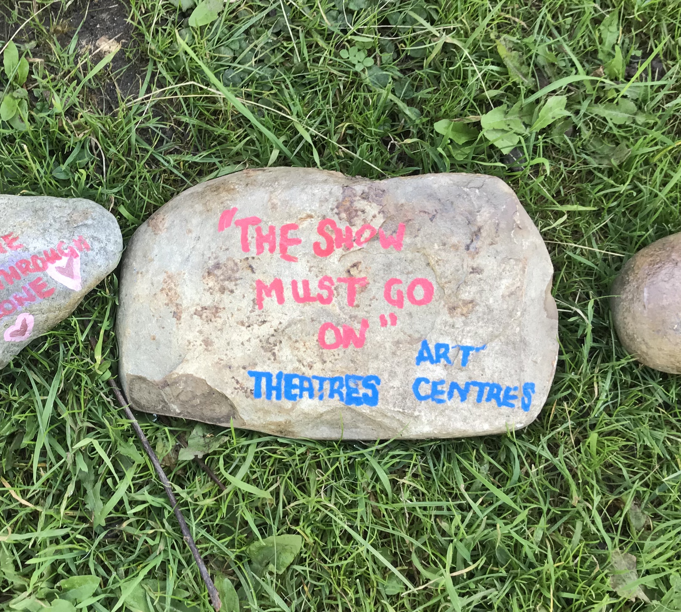
After the tunnels, the canal skirts the edge of Barnton village and the town of Northwich with houses and gardens backing onto the towpath. At one house, the owner had painted a long line of stones to thank and support all the groups of people who have found the pandemic extra tough or have helped others: police, careworkers, refuse collectors, refugees, theatres and scientist to name just a few. The line must have had close to a hundred stones and there was a sign encouraging passers-by to add any group that had been missed.
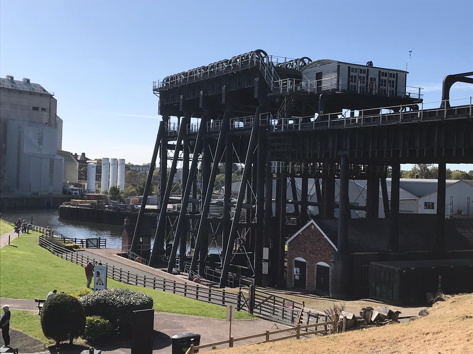
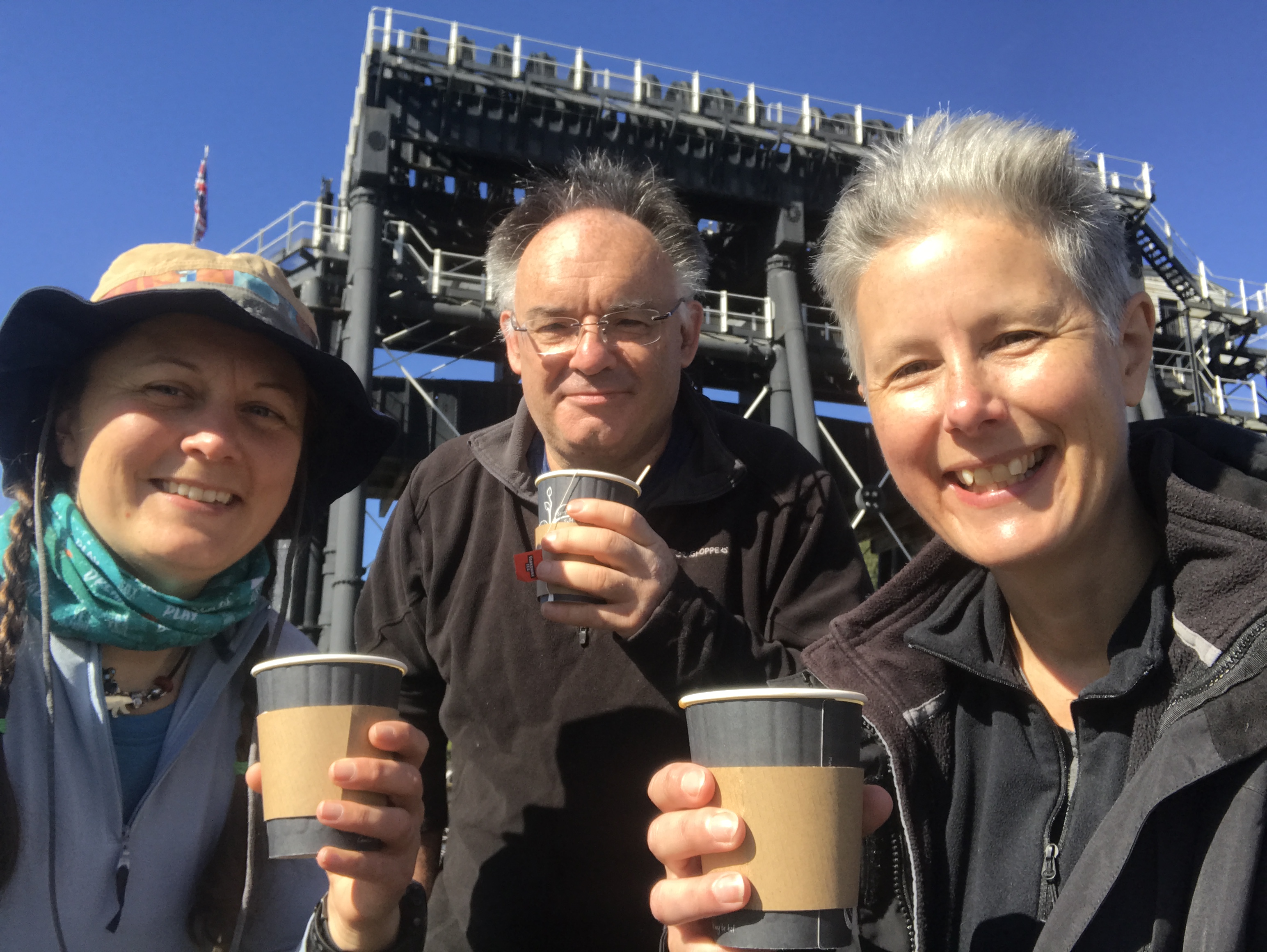
The Anderton Boat Lift deserves a blog of its own. It was built to enable boats to move between the Weaver Navigation and the canal, a drop of some 15 metres from the canal. It’s still in operation but we weren’t lucky enough to see it working while we had a cup of tea in the visitor centre garden.
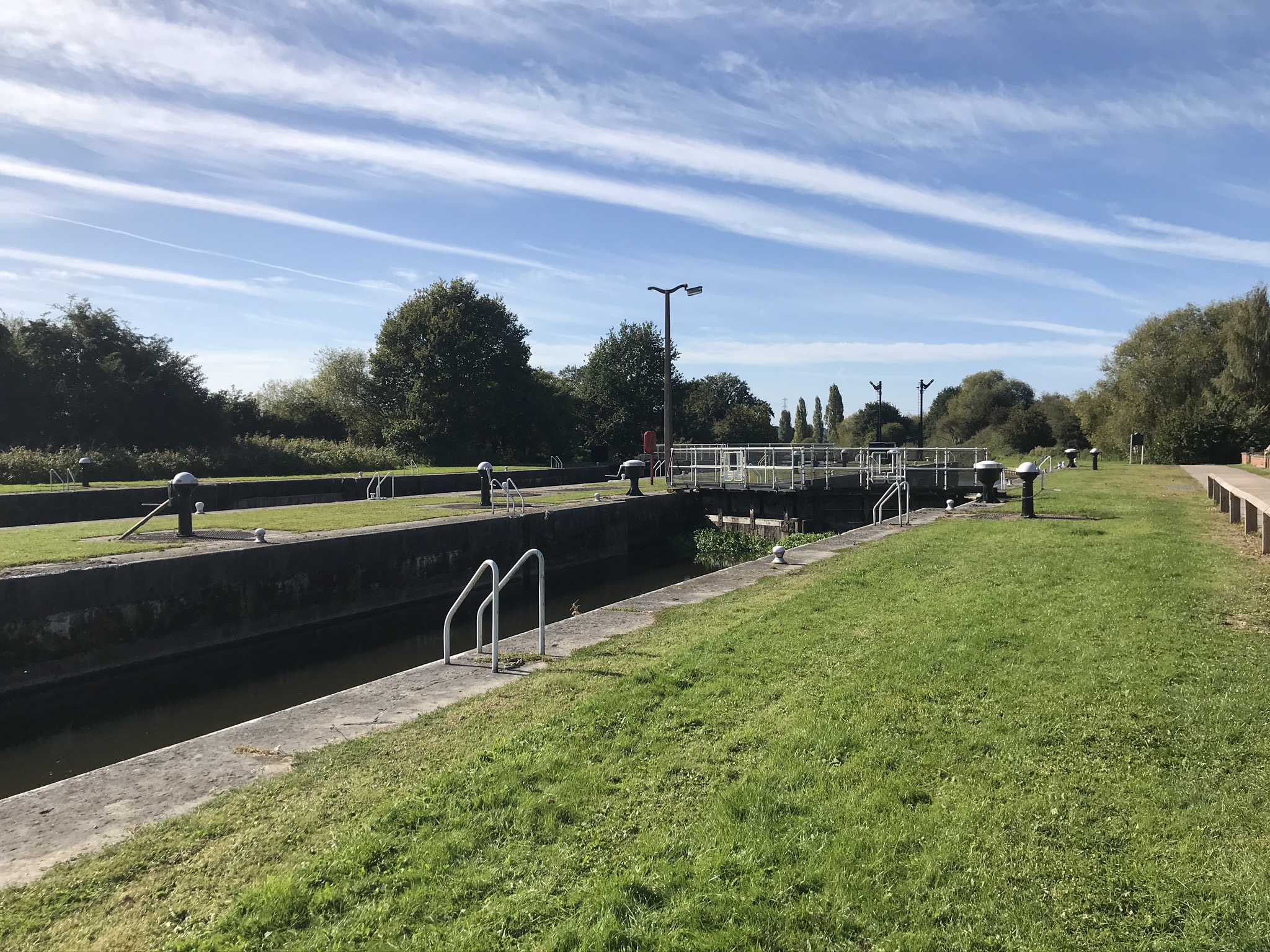
Retracing our steps this was now the North Cheshire Way and after walking up and over one of the tunnels we turned away from the narrow tree lined canal to the wide and open river. The twin locks at Saltersford are huge and imposing; though quiet now the river was once a motorway of the water ways. We stopped here for cake, lounging in the sun on a mown grassy bank watching a diving bird, possibly a Shag, fishing along the opposite bank.

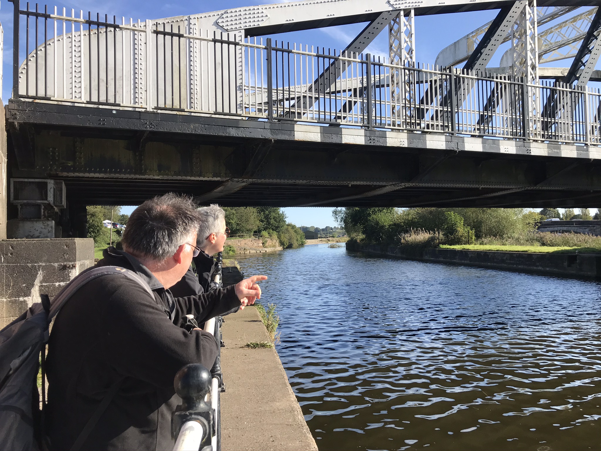
The rest of the walk followed the river on wide field edges all the way back to the swing bridge at Acton Bridge, and tempting though it was to continue along the river we had reached the end of the day’s walk.
Video of the walk is HERE
The route is available on the Ordnance Survey website HERE
| Cheshire Challenge distance | 11.65km |
| Paths walked | Trent and Mersey Canal Walk, North Cheshire Way |
| Total distance | 12.1km |
| Total ascent | 172m |
| OS map | OS Explorer 267 |
| Date walked | 27th September 2020 |
| Time taken | 5 hours |
| Cake | Apple cake |
| Dance pose | Forgot, but we did sing! |
| Total Cheshire Challenge distance completed | 145km (1500km in total) |
